place

Waysons Corner, Maryland

Anne Arundel County, Maryland geography stubsUnincorporated communities in Anne Arundel County, MarylandUnincorporated communities in MarylandUse mdy dates from July 2023
2016 09 11 09 20 24 View north up the Patuxent River from the Maryland State Route 4 (Stephanie Roper Highway) bridge connecting Waysons Corner, Anne Arundel County, Maryland with Marlboro Meadows, Prince Georges County, Maryland

Waysons Corner is an unincorporated community in Anne Arundel County, Maryland, United States, 2.6 miles (4.2 km) east of Upper Marlboro. Waysons Corner is located at the junction of Maryland routes 4 and 408 (Southern Maryland Boulevard), where the former changes names to Pennsylvania Avenue.

Excerpt from the Wikipedia article Waysons Corner, Maryland (License: CC BY-SA 3.0, Authors, Images).

Waysons Corner, Maryland
Mount Zion Marlboro Road,

Geographical coordinates (GPS) Address Nearby Places
placeShow on map

Wikipedia: Waysons Corner, MarylandContinue reading on Wikipedia

Geographical coordinates (GPS)

Latitude Longitude
N 38.811111111111 ° E -76.7025 °
placeShow on map

Address

Shell

Mount Zion Marlboro Road 1378
20711
Maryland, United States
mapOpen on Google Maps

2016 09 11 09 20 24 View north up the Patuxent River from the Maryland State Route 4 (Stephanie Roper Highway) bridge connecting Waysons Corner, Anne Arundel County, Maryland with Marlboro Meadows, Prince Georges County, Maryland
Share experience

Nearby Places

Mount Pleasant (Upper Marlboro, Maryland)

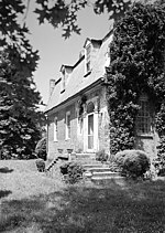
Mount Pleasant is 2+1⁄2-story brick structure with a gambrel roof and is about two-thirds its original length. It is located near Upper Marlboro in Prince George's County, Maryland. Mount Pleasant was patented in 1697 to Richard Marsham, whose wife Anne was the daughter of Leonard Calvert, Governor of Maryland. Their grandson, Marsham Waring, inherited the home from his grandfather in 1713. His son, Richard Marsham Waring had a son, Richard Marsham Jr., born in 1733, who then inherited Mount Pleasant and Patented and Certified the tract of land dubbed "Mount Pleasant Enlarged" in 1760. On August 21, 1764, Richard Marsham Jr. sold the 451+3⁄4 acre tract of land to his brother John for £474.6s.9d. John later built the standing house in the years between 1764 and 1785 (conflicting dates). John died in 1813 and was buried at Mount Pleasant.Mount Pleasant is an example of an almost distinctively Maryland style of house—the English gambrel roof dwelling in brick, with the steep gambrel which has dormers almost flush with the second pitch of the roof. This house is significant primarily for its architecture and as a representative example of a more modest type of mid-Georgian dwelling than others in Maryland such as Montpelier, and probably a closer reflection of the architectural ancestry than the Palladian country house. As a more modest dwelling Mount Pleasant is an unusual survivor.Thomas Fielder Bowie is interred in the Waring family burial ground on this site.

Prince George's County Sheriff's Office

The Prince George's County Sheriff's Office (PGSO), officially the Office of the Sheriff, Prince George's County, provides law enforcement services in Prince George's County, Maryland in the United States. Its headquarters are located in Upper Marlboro, near the Depot Pond. The sheriff is the chief law enforcement officer of Prince George's County and is elected every four years. There are no term limits for the sheriff.Created in 1696, the traditional duties of the sheriff are keeper of the public peace and the enforcement arm of the county court, analogous to the U.S. Marshals Service. The PGSO has a relatively long history compared to other police departments and sheriff's offices in Maryland. The PGSO was involved with events that occurred during the burning of Washington and affected the writing of "The Star-Spangled Banner". Prior to 1931, the PGSO was the sole law enforcement organization of the county.Today, the duties of the sheriff include law enforcement services of the two county courthouses and surrounding property, service of court-ordered warrants, writs, protective orders, and other injunctions, and limited patrol responsibility with the County Police. The Domestic Violence Unit has expanded its role in the county to include responding to calls for service that are domestic-related. The creation of the School Resource Deputy division has placed a deputy sheriff at all of the local high schools, replacing the County Police. All other law enforcement services of the county are provided by multiple agencies but mostly left to the separate Prince George's County Police Department (PGPD), though some responsibilities are shared by both agencies. The PGSO, like most other county-level law enforcement agencies in the United States, is a progressive agency with an array of services, from the Specialized Services Team (dealing with high-risk arrest warrants and barricaded situations) to community services aiding the county's residents in safety education. The PGSO was accredited for the first time by the Commission on Accreditation for Law Enforcement Agencies, Inc. (CALEA) in 2018.