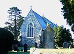
Llanfihangel Ystrad
Ceredigion geography stubsVillages in Ceredigion

Llanfihangel Ystrad (English "Vale of St Michael") is a constituent community in Ceredigion, Wales. It is named after the principal place of worship, St Michael's church at Ystrad Aeron.The total population of the community taken at the United Kingdom Census 2011 was 1,430.Villages within the community include Ystrad Aeron, Dihewyd, Cribyn and Temple Bar.
Excerpt from the Wikipedia article Llanfihangel Ystrad (License: CC BY-SA 3.0, Authors, Images).Llanfihangel Ystrad
B4342,
Geographical coordinates (GPS) Address Nearby Places Show on map
Geographical coordinates (GPS)
| Latitude | Longitude |
|---|---|
| N 52.183333333333 ° | E -4.1666666666667 ° |
Address
B4342
SA48 7PQ , Llanfihangel Ystrad
Wales, United Kingdom
Open on Google Maps


