place

Rayners Lane tube station

1906 establishments in EnglandCharles Holden railway stationsFormer Metropolitan Railway stationsGrade II listed buildings in the London Borough of HarrowGrade II listed railway stations
Metropolitan line stationsPiccadilly line stationsRail transport stations in London fare zone 5Railway stations in Great Britain opened in 1906Tube stations in the London Borough of HarrowUse British English from August 2012
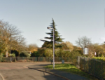
Rayners Lane Station 10 Jan 2019

Rayners Lane is a London Underground station in the district of Rayners Lane in north west London, amid a 1930s development originally named Harrow Garden Village. The station is on the Uxbridge branch of both the Metropolitan line, between Eastcote and West Harrow stations, and the Piccadilly line, between Eastcote and South Harrow stations. The station is located to the west of the junction of Rayners Lane, Alexandra Avenue and Imperial Drive (A4090). It is in Travelcard Zone 5. Just east of the station, the Piccadilly and Metropolitan lines tracks join for services to Uxbridge and separate for those to Central London.

Excerpt from the Wikipedia article Rayners Lane tube station (License: CC BY-SA 3.0, Authors, Images).

Rayners Lane tube station
Rayners Lane, London Rayners Lane (London Borough of Harrow)

Geographical coordinates (GPS) Address Nearby Places
placeShow on map

Wikipedia: Rayners Lane tube stationContinue reading on Wikipedia

Geographical coordinates (GPS)

Latitude Longitude
N 51.575277777778 ° E -0.37138888888889 °
placeShow on map

Address

Rayners Lane

Rayners Lane
HA5 5EG London, Rayners Lane (London Borough of Harrow)
England, United Kingdom
mapOpen on Google Maps

Rayners Lane Station 10 Jan 2019
Share experience

Nearby Places

North Harrow
North Harrow

North Harrow is a suburban area of North West London, situated north-west of central Harrow within the London Borough of Harrow. Its residential roads have expanded from North Harrow tube station, a station on the Metropolitan line of the London Underground which is one stop away from Harrow-on-the-Hill station in Harrow town centre. Before North Harrow tube station was opened and the suburb developed, the area was known as Hooking Green. North Harrow's statistics exceed the London average in terms of safety, affluence and quality of education of its schools. In the area, there is predominantly low-rise, low-density, high floor space housing; there is substantial parkland in the neighbourhood such as on all sides of Headstone Manor, Yeading Brook Open Space and miniature railway and sports ground in adjoining pasture grasslands of Pinner Park, contrasted with diverse amenities, particularly in the areas of the tube station, Imperial Drive and along Pinner Road, including a post office, Tesco Express, a selection of restaurants, take-aways and cafés and independent specialist shops. The area is also served by North Harrow Library.North Harrow is part of Harrow West along with West Harrow and central Harrow, a parliamentary constituency represented by Labour Party (UK) MP Gareth Thomas. About 800m north of the tube line is a 14th-century moated manor house, Headstone Manor, which serves to support the area's excellence in sport with public grounds on all sides as well as Harrow Museum and Heritage Centre, which is based in Headstone Manor Recreation Ground. The Heritage Centre chronicles Harrow's historical past and runs many special events and exhibitions throughout the year.