Rayners Lane
Areas of LondonDistricts of the London Borough of HarrowMiddlesexStreets in the London Borough of HarrowUse British English from September 2015

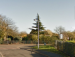
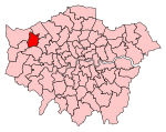
Rayners Lane is a suburban district in the London Borough of Harrow that forms the western part of Harrow. Located between Pinner and West Harrow, it takes its name from a road in the area, also called Rayners Lane (formerly also spelt Rayner's Lane) which runs from Marsh Road in Pinner to Eastcote Lane in South Harrow.
Excerpt from the Wikipedia article Rayners Lane (License: CC BY-SA 3.0, Authors, Images).Rayners Lane
Worple Way, London Rayners Lane (London Borough of Harrow)
Geographical coordinates (GPS) Address Nearby Places Show on map
Geographical coordinates (GPS)
| Latitude | Longitude |
|---|---|
| N 51.5737 ° | E -0.3735 ° |
Address
Worple Way
Worple Way
HA2 9SP London, Rayners Lane (London Borough of Harrow)
England, United Kingdom
Open on Google Maps


