place

Miquon, Pennsylvania

AC with 0 elementsPopulated places on the Schuylkill RiverUnincorporated communities in Montgomery County, PennsylvaniaUnincorporated communities in Pennsylvania
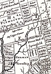
Barren hill map
Barren hill map

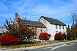
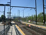
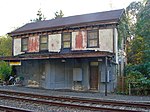
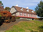
Miquon is a small, unincorporated community in Montgomery County, Pennsylvania. Located partly in Whitemarsh Township and partly in Springfield Township, it lies between the Roxborough section of Philadelphia and the Spring Mill section of Whitemarsh Township. Its borders are, roughly, Barren Hill Road, Ridge Pike, Manor Road, and the Schuylkill River. The sections of Miquon along the river and west of Harts Lane share the 19428 zip code with Conshohocken. The section east of Harts Lane shares the 19444 zip code with Lafayette Hill. The name “Miquon” comes from the language of the Lenni-Lenape people, who were the original inhabitants. The notable Battle of Barren Hill during the Revolutionary War began just east of Miquon (on May 20, 1778): When set upon by some 16,000 British troops, the Marquis de Lafayette and his 2,200 Continental troops eluded capture by retreating through Miquon, across the river, and back to their camp at Valley Forge. In the 19th century, Miquon became a center of the papermaking industry. The W. C. Hamilton Paper Company operated its mills along the river there until the mid 20th century. In 1999, the former mill buildings were redeveloped into an office complex (named River Park I and River Park II). In 2012, River Park II became the campus of AIM Academy, a private secondary school. The tracks of the old Reading Railroad run through Miquon along the Schuylkill River. In around 1880, that railroad opened a passenger station in Miquon, at Manor Road, known as Lafayette Station. The design of the building that housed that station is attributed to the architect Frank Furness. It remained the local passenger railroad station until 1910, and the building still stands today.Miquon’s current local passenger railroad station, built around 1910 (and renamed “Miquon Station” in 1921) is located to the southeast of the old station building; the old Reading Railroad tracks now carry the Manayunk/Norristown Line.

Excerpt from the Wikipedia article Miquon, Pennsylvania (License: CC BY-SA 3.0, Authors, Images).

Miquon, Pennsylvania
Miquon School Driveway,

Geographical coordinates (GPS) Address Nearby Places
placeShow on map

Wikipedia: Miquon, PennsylvaniaContinue reading on Wikipedia

Geographical coordinates (GPS)

Latitude Longitude
N 40.067430555556 ° E -75.268980555556 °
placeShow on map

Address

Miquon School

Miquon School Driveway
19444
Pennsylvania, United States
mapOpen on Google Maps

Barren hill map
Barren hill map
Share experience

Nearby Places

Spring Mill, Pennsylvania

Spring Mill is a small unincorporated community in Whitemarsh Township, Montgomery County, Pennsylvania. Located along the Schuylkill River, it lies between the community of Miquon and the Borough of Conshohocken. Conshohocken's southeast border cuts diagonally across the street grid – from 12th Avenue, south of Righter Street, to approximately where Cherry Street meets the river. "Spring Mill" was first a gristmill, built sometime between 1697 and 1704. The mill lent its name to Spring Mill Creek and the surrounding area. The mill burned in 1967, and its stone ruins were demolished. The miller's house survives, and is listed on the National Register of Historic Places.Spring Mill Station was established by the Reading Railroad about 1880. The modern station is part of the SEPTA Manayunk/Norristown Line. Located along the river at North Lane, it is subject to periodic flooding.The Schuylkill River Trail passes through the community. Spring Mill shares Conshohocken's 19428 zip code. Spring Mill until recently was the most populous village in the township, but owing to the demolition of its furnaces and several manufacturing establishments, its prosperity has been impaired. It is situated on the east side of the Schuylkill, with two railroads having double tracks passing through it from Philadelphia. It contains at present four stores, one hotel, two clay-works, a grist-mill, several mechanic shops and about fifty houses. The census of 1880 gives seven hundred and eighty-eight inhabitants; if this is no typographical error, it is entirely too high; the number of houses will not admit of half this population. Mr. Hitner has sold his two furnaces here to the Schuylkill Valley Railroad Company to give them room for improvements. The village received its name from several copious springs of water near by, the principal ones being five or six in number. They are all situated within an area of half an acre, and flow into one stream, which after a course of a quarter of a mile, empties into the Schuylkill. In this distance it has sufficient power to propel the whole year round the grist-mill mentioned, which was built here before 1715, and then owned by David Williams, next by Robert Jones. Thomas Livezey, in January 1812, advertised it for rent, stating that it was affected by "neither frost nor drought." Mr. Hitner's furnaces were erected here in 1844 and 1853, with an estimated capacity to produce annually twelve thousand tons of iron. John Meconkey advertised the tavern and ferry here for sale in December 1803, stating that the house was thirty-five by eighteen feet, two stories high, with an ice-house attached, and that the ferry had the advantage of not being fordable at any time of the year. Edge Hill crosses the Schuylkill just below the village, and continues up the other side of the river to West Conshohocken, where it turns to the southwest. The river is quite narrow where it flows through the hill and rises on both sides to an elevation of upwards of two hundred and fifty feet, contributing to the beauty of the scenery. Its flourishing neighbor, Conshohocken, bids fair to absorb the entire place, it being no easy matter now to a stranger to tell where the one begins and the other ends. The post-office here is called William Penn, and was established before 1876. — History of Montgomery County (1884).

Lafayette Hill, Pennsylvania

Lafayette Hill is a small unincorporated community in primarily Whitemarsh Township, Montgomery County in the Commonwealth of Pennsylvania. A small part of it is in Springfield Township. Lafayette Hill is located just west of Philadelphia's Chestnut Hill neighborhood, and south of Plymouth Meeting. Lafayette Hill draws its name from the French General Marquis de Lafayette, who stayed there during the American Revolution. Before the general decampment from Valley Forge in the spring of 1778, George Washington dispatched an estimated 2,200 troops under the command of Marquis de Lafayette to act as a defensive screen and to conduct reconnaissance of the British army, which had garrisoned in Philadelphia for the winter. The two forces had a brief engagement at nearby Barren Hill. Lafayette Hill is an area with many parks and nature reserves. It is home to a Jewish community and Catholic population anchored by St. Philip Neri Church, Congregation Or Ami, and Whitemarsh Valley Country Club. Many people commute to Philadelphia to work. Its main transit system is SEPTA. Lafayette Hill is home to the Barren Hill Volunteer Fire Company, one of the oldest fire companies in the area. It was founded after a fire destroyed a farm along with several livestock in 1915. Currently, Barren Hill Fire Company has roughly 400 to 500 calls for service each year. Their 1977 firehouse is located on 641 Germantown Pike. Whitemarsh Township is also served by the Spring Mill Fire Company. Lafayette Hill is served by the Colonial School District. Notable people from Lafayette Hill, Pennsylvania include: Terrence Howard, John Salmons, Da'Rel Scott, Brad Furman, Reece Whitley, Billionaire Michael G. Rubin, and retired NBA player Allen Iverson.