place

Queen Anne Historic District

Historic districts in Berks County, PennsylvaniaHistoric districts on the National Register of Historic Places in PennsylvaniaNRHP infobox with nocatNational Register of Historic Places in Reading, PennsylvaniaUse mdy dates from August 2023
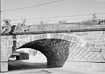
Queen Anne HD McKnight n Windsor

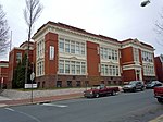
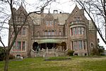
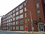
Queen Anne Historic District is a national historic district located in Reading, Berks County, Pennsylvania. The district encompasses 2,405 contributing buildings in Reading built between about 1880 and 1925. The district consists primarily of semi-detached houses and rowhouses, with a few stone church buildings and small commercial buildings. Most of the buildings are constructed of brick and reflective of Late Victorian and early 20th-century architectural styles. The churches are St. Mary's Episcopal Church (1904) and Wesley United Methodist Church (1922). Located in the district and separately listed are the Charles S. Foos Elementary School and former Meinig Glove Factory-E. Richard Meinig Co.It was listed on the National Register of Historic Places in 2004.

Excerpt from the Wikipedia article Queen Anne Historic District (License: CC BY-SA 3.0, Authors, Images).

Queen Anne Historic District
McKnight Street, Reading

Geographical coordinates (GPS) Address Nearby Places
placeShow on map

Wikipedia: Queen Anne Historic DistrictContinue reading on Wikipedia

Geographical coordinates (GPS)

Latitude Longitude
N 40.348611111111 ° E -75.936944444444 °
placeShow on map

Address

McKnight Street 842
19601 Reading
Pennsylvania, United States
mapOpen on Google Maps

Queen Anne HD McKnight n Windsor
Share experience

Nearby Places

Reading, Pennsylvania

Reading ( RED-ing; Pennsylvania German: Reddin) is a city in and the county seat of Berks County, Pennsylvania, United States. The city had a population of 95,112 at the 2020 census and is the fourth-largest city in Pennsylvania after Philadelphia, Pittsburgh, and Allentown. Reading is located in the southeastern part of the state and is the principal city of the Greater Reading Area, which had 420,152 residents in 2020. Reading gives its name to the now-defunct Reading Company, also known as the Reading Railroad, and since acquired by Conrail, that played a vital role in transporting anthracite coal from the Pennsylvania's Coal Region to major East Coast metropolitan markets through the Port of Philadelphia for much of the 19th and 20th centuries. Reading Railroad is one of the four railroad properties in the classic U.S. version of the Monopoly board game. Reading was one of the first localities where outlet shopping became a tourist industry. It has been known as "The Pretzel City" because numerous local pretzel bakeries are based in the city and its suburbs; currently, Bachman, Dieffenbach, Tom Sturgis, and Unique Pretzel bakeries call the Reading area home. In recent years, the Reading area has become a destination for cyclists with more than 125 miles of trails in five major preserves; the region is an International Mountain Bicycling Association ride center.According to 2010 U.S. census data, Reading had the highest share of citizens living in poverty in the nation among cities with populations exceeding 65,000. Reading's poverty rate fell over the next decade. Reading's poverty rate in the five-year American Community Survey, published in 2018, showed that 35.4% of the city's residents were below the poverty line, or less "than the infamous 41.3% from 2011, when Reading was declared the poorest small city in the nation."Reading is located 38.8 miles (62.4 km) southwest of Allentown and 62.9 miles (101.2 km) northwest of Philadelphia.