place

South Shields

Metropolitan Borough of South TynesidePopulated coastal places in Tyne and WearPort cities and towns of the North SeaSeaside resorts in EnglandSouth Shields
Towns in Tyne and WearUnparished areas in Tyne and Wear
Hôtel ville South Shields South Tyneside 28

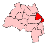
South Shields is a coastal town in South Tyneside, Tyne and Wear, England. It is situated at the south of the River Tyne. Historically, it was known to Romans as Arbeia and as Caer Urfa by Early Middle Ages. According to the 2011 census, the town had a population of 75,337. It is the fourth largest settlement in Tyne and Wear; after Newcastle upon Tyne, Sunderland and Gateshead. It is roughly equidistant (approximately 3.7 miles (6.0 km) between the border of Newcastle and the border of Sunderland.South Shields is represented in Parliament by Labour MP Emma Lewell-Buck. The town became part of Tyne and Wear in 1974. It is within the historic county boundaries of County Durham.

Excerpt from the Wikipedia article South Shields (License: CC BY-SA 3.0, Authors, Images).

South Shields
South Tyneside The Lawe

Geographical coordinates (GPS) Address Nearby Places
placeShow on map

Wikipedia: South ShieldsContinue reading on Wikipedia

Geographical coordinates (GPS)

Latitude Longitude
N 54.995 ° E -1.43 °
placeShow on map

Address


NE33 4NU South Tyneside, The Lawe
England, United Kingdom
mapOpen on Google Maps

Hôtel ville South Shields South Tyneside 28
Share experience

Nearby Places

South Shields railway station

South Shields railway station was the main railway station for South Shields, in Tyne and Wear, North-East England. The station was located on Mile End Road in the town centre. The station was opened by the NER in 1879 as the terminus of their newly extended Newcastle and South Shields Railway branch from Pelaw via Hebburn and had two platforms and an ornate overall roof. The town had been rail-served by some years prior to this - the Stanhope and Tyne Railway had opened their route from Washington back in 1834, whilst the Brandling Junction Railway followed with a branch from Brockley Whins five years later. Both these companies (and the S&T's successor the Pontop and South Shields Railway) had though been purely concerned with mineral traffic and passenger provision was limited. The new route though was built to carry passengers from the outset as well as coal & iron ore to/from Tyne Dock and had regular services to both Newcastle Central via Gateshead and to Sunderland, these running via the old BJR route via Tyne Dock and East Boldon. The 1923 Grouping saw the station pass from the NER into the control of the London and North Eastern Railway. Services on both routes remained well used and in 1938, the line from Newcastle was electrified on the 660 V DC system as an extension of the existing North Tyneside suburban network.Nationalisation in 1948 saw the station become part of British Railways North Eastern Region, but over the next few years services began to decline - those to Whitburn Colliery ended in November 1953, whilst the direct Sunderland trains fell victim to the Beeching Axe in May 1965 (passengers thereafter having to change at Pelaw). The Newcastle line was also converted to diesel multiple unit operation in 1963, with BR stating that it was cheaper to remove the third rail than renew the electrical equipment on the route. Though it survived the Beeching cuts, by the 1970s the station (and route) had become increasingly run down and so it was a logical choice to be included in the planned Tyne & Wear Metro network.It was eventually closed on 1 June 1981, when the line was temporarily shut down for conversion to Metro operation. It was replaced by a new South Shields Metro station a short distance to the south, when the line reopened in 1984. The station building survived as an entrance to the Metro system until the 1990s, when it was demolished. Today, a Shopmobility centre stands on the site of the original station building. The new building was built to a similar style as the station it replaced. The platforms behind have been removed, but the rest of the site is still used by Metro as carriage & engineers' sidings. In early 2019 a new interchange opened there which is also a bus terminal. The same tracks are used but the platform has moved.

Chichester Metro station

Chichester () is a station on the Tyne and Wear Metro serving the Chichester, Laygate, Westoe and West Park areas of South Tyneside, as well as the nearby South Tyneside College campus. The station is affectionately referred to as 'Chi' by locals. The station was used by approximately 390,000 passengers in 2017-18. The Tyne & Wear Metro station at Chichester was opened in March 1984, and completed the initial Metro network. It was originally a station on the Green Line from Bank Foot (until 1991), and later, Airport. Since 2005, the station has been on the Yellow Line from St. James. A statue of Queen Victoria had been moved to Chichester in 1949, from its original position in front of South Shields Town Hall. In 1981, it was removed to make way for the new Metro station at Chichester, and returned to its original position at the front of the Town Hall, where it remains today. Chichester is situated on the former Stanhope & Tyne Railway route, rather than the former Brandling Junction Railway route via High Shields. Part of this line had been transferred into National Coal Board ownership, and to the south of the station was a single-track electrified freight line, part of the Harton Colliery system. In the early 1990s, this line was de-electrified, and following the closure of Westoe Colliery in 1993, has been closed completely. The former colliery line along Chichester Road was regenerated in the late 1990s, being replaced with a supermarket. The line itself was also the spot of the Westoe Netty, an open air public urinal which was depicted in a famous 1972 painting by Bob Olley. These toilets were saved when the colliery line was demolished, and are now preserved at the Beamish Open Air Museum in County Durham. In regards to the station, the colliery line ran behind Platform 2 with the tunnel beneath the concourse still visible from the Dean Road bridge. Chichester was intended as one of the original interchange stations, which meant buses were timetabled to interchange with Metro services. This arrangement broke down after the deregulation of local bus services in 1986. Today, Chichester still serves as one of the Metro's main bus interchanges, due to the close proximity of the Stagecoach bus depot, but now serves mainly for nearby residential areas, as well as the South Tyneside College campus. The platforms at Chichester are below street level, however the ticket hall is at ground level. The ticket hall contains two ticket machines and a newsagent. The station also houses four bicycle lockers. Following the opening of the new South Shields Interchange in August 2019, Chichester is the single remaining station on the branch from Pelaw to South Shields which has yet to be refurbished. In November 2014, two pieces of artwork produced by community group Bright Futures were installed in the station. It is also unique in having station signage in blue, instead of the original yellow, due to an advertising deal with South Tyneside College.

South Tyneside College

South Tyneside College is a large further education college in South Tyneside in North East England. Its main site is in the town of South Shields. The college offers part-time and full-time courses for young students and adults. It was formed in 1984 by the merger of Hebburn Technical College and the Marine and Technical College, the latter founded in 1861 by a trust created by Dr Thomas Winterbottom, a former surgeon-general in Sierra Leone. The college is still one of the largest merchant navy training colleges in the United Kingdom, and attracts students from as far afield as India and Africa. It offers courses in marine subjects marine education such as navigation, operations, mechanical and electrical engineering, communications, and catering. The Marine and Technical College was formerly based in Ocean Road, South Shields, in a purpose-built building opened in 1869. This is now a public house called Kirkpatricks. There is a marine simulation centre on the main Westoe Campus and college sites throughout South Shields, such as: the Marine Safety Training Centre on Wapping Street; the Radar Station next to Ocean Beach Pleasure Park and the St. Hilda's Centre on Coronation Street. The former planetarium was closed in 2008, despite much local objection, and the space now houses a multi-faith chaplaincy. The college also used to own a campus in Hebburn however this was closed in 2011 due to upkeep costs. Also situated on the Westoe Campus, is the Dr Winterbottom Halls of Residence, otherwise known as "The Coronadrome". Opening in 1978, Dr Winterbottom Halls of Residence comprises six residential blocks, with the majority of the residents being marine students. It became a tertiary college in 1986 after the council's education reorganisation.