Barnoldswick

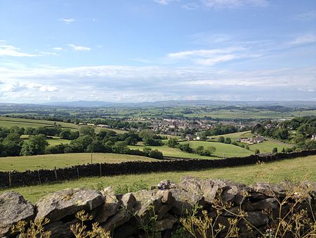
Barnoldswick (pronounced ) is a market town and civil parish in the Borough of Pendle, in the administrative county of Lancashire, England. It is within the boundaries of the historic West Riding of Yorkshire. Barnoldswick and the surrounding areas of West Craven have been administered since 1974 as part of the modern administrative county of Lancashire. This was when West Riding County Council and Barnoldswick Urban District Council were abolished and the town was transferred to the Borough of Pendle. Situated 30 miles (48 km) from Leeds, Manchester and Preston, nearby towns include Skipton to the east, Clitheroe to the west, Burnley to the south, and Keighley to the east southeast. The civil parish has a population of 10,752.
Excerpt from the Wikipedia article Barnoldswick (License: CC BY-SA 3.0, Authors, Images).Barnoldswick
Bethesda Street, Borough of Pendle
Geographical coordinates (GPS) Address Nearby Places Show on map
Geographical coordinates (GPS)
| Latitude | Longitude |
|---|---|
| N 53.9147 ° | E -2.1895 ° |
Address
Bethesda Street
Bethesda Street
BB18 5PB Borough of Pendle
England, United Kingdom
Open on Google Maps


