place

Bracewell and Brogden

Civil parishes in LancashireGeography of the Borough of PendleHistory of YorkshireLancashire geography stubsUse British English from March 2015
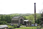
New House, Bracewell, near Barnoldswick geograph.org.uk 871566

Bracewell and Brogden is a civil parish in the West Craven area of the Borough of Pendle in Lancashire, England. According to the 2001 census it had a population of 238, increasing slightly to 244 at the 2011 census. The parish includes Bracewell (at grid reference SD863485) and Brogden (at SD858472); historically, both were in the West Riding of Yorkshire.

Excerpt from the Wikipedia article Bracewell and Brogden (License: CC BY-SA 3.0, Authors, Images).

Bracewell and Brogden
Bracewell Lane, Borough of Pendle Bracewell and Brogden

Geographical coordinates (GPS) Address Nearby Places
placeShow on map

Wikipedia: Bracewell and BrogdenContinue reading on Wikipedia

Geographical coordinates (GPS)

Latitude Longitude
N 53.932 ° E -2.212 °
placeShow on map

Address

Bracewell Lane
BD23 3JU Borough of Pendle, Bracewell and Brogden
England, United Kingdom
mapOpen on Google Maps

New House, Bracewell, near Barnoldswick geograph.org.uk 871566
Share experience

Nearby Places

Horton, Lancashire
Horton, Lancashire

Horton, historically known as Horton-in-Craven, is a village and a civil parish in the Ribble Valley district of the English county of Lancashire (historically in the West Riding of Yorkshire). Population details are now included in the civil parish of Newsholme. It is near the town of Barnoldswick. Horton has a place of worship, anciently called a chapelry or chapel of ease. For transport, there is the A59 nearby. The parish adjoins the Ribble Valley parishes of Gisburn, Paythorne and Newsholme, the Pendle parish of Bracewell and Brogden and the parishes of Hellifield and Martons Both in the Craven district of North Yorkshire. According to the census of 2001, the parish had a population of 76, however the United Kingdom Census 2011 grouped the parish with Newsholme and Paythorne (2001 pop. 50 and 95), giving a total of 253.The name Horton is a common one in England. It derives from Old English horu 'dirt' and tūn 'settlement, farm, estate', presumably meaning 'farm on muddy soil'. This example is first attested in the Domesday Book of 1086. In the west of the parish in the Little Painley area, on high ground near the River Ribble, is the site of a Bronze Age Bowl barrow.Horton was once a township in the ancient parish of Gisburn, in the Staincliffe Wapentake of the West Riding of Yorkshire. This became a civil parish in 1866, forming part of the Bowland Rural District from 1894 to 1974. It has since become part of the Lancashire borough of Ribble Valley. Along with Rimington, Gisburn, Middop, Gisburn Forest, Paythorne and Newsholme, the parish forms the Gisburn, Rimington ward of Ribble Valley Borough Council.The Pennine Bridleway National Trail and Ribble Way pass through the parish.