Lake Tahoe Dam

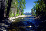
Lake Tahoe Dam is a concrete gravity dam on the Truckee River, at the outlet of Lake Tahoe in Placer County, California. Tahoe Dam regulates the top six feet of Lake Tahoe, and distributes the water into Tahoe's primary outflow, the Truckee River. The dam is located in Tahoe City and serves as the main storage facility for the U.S. Bureau of Reclamation's Newlands Project that also includes the Lahontan Dam and two diversion dams, providing irrigation water for 55,000 acres (22,000 ha) of cropland mainly in the Lahontan Valley of western Nevada. The present Lake Tahoe dam replaced an older, privately owned dam built in 1870 at roughly the same location.The dam was built between 1909 and 1913 and stands 18.2 ft (5.5 m) high and 109 ft (33 m) long, raising Lake Tahoe by up to 10.1 ft (3.1 m). Outflows from the dam are regulated by a gated spillway with 17 bays, with a maximum release capacity of 2,100 cubic feet per second (59 m3/s). It is situated 400 feet downstream from the lake's natural shore. This is meant to help hydraulic control during a dry season with low water levels. The reservoir receives water from a catchment of 505 sq mi (1,310 km2) and has a maximum storage capacity of 732,000 acre⋅ft (0.903 km3).
Excerpt from the Wikipedia article Lake Tahoe Dam (License: CC BY-SA 3.0, Authors, Images).Lake Tahoe Dam
Fanny Bridge,
Geographical coordinates (GPS) Address Nearby Places Show on map
Geographical coordinates (GPS)
| Latitude | Longitude |
|---|---|
| N 39.167213 ° | E -120.143926 ° |
Address
Fanny Bridge
96145
California, United States
Open on Google Maps


