place

Chapel Stile

Cumbria geography stubsSouth Lakeland DistrictUse British English from September 2019Villages in Cumbria
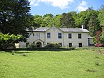
Church in Chapel Stile geograph.org.uk 32781

Chapel Stile is a village in Cumbria, England, located approximately 5 miles northwest of Ambleside, within the Langdale valley. It contains a school, Holy Trinity church, the Co-op and the Wainwrights' Inn (formerly The Langdale Hotel), and a quarry is located in the vicinity. Couples who choose to get married at the church are traditionally 'tied in' during the service. The local children tie up the church gates and the newlyweds are only released when coins (of small denomination) are thrown to said children. The Co-op has been established for well over a hundred years. Chapel Stile also gives access to the Langdale Pikes, Pike o' Stickle and Harrison Stickle. Other notable fells nearby are Pavey Ark, Bowfell and Pike o' Blisco. Rock climbing in the area includes Raven Cragg. A worthy climbing venue and less populated than its famous counterpart further in the Langdale valley at the back of the Old Dungeon Ghyll. In popular culture, or at least 'underground popular culture', there is a nu jazz track called 'Chapel Stile' by Pretz (N.Cowley). Due to its location within a popular tourist destination, around 85% of the homes within the community are now either second homes or holiday lets.

Excerpt from the Wikipedia article Chapel Stile (License: CC BY-SA 3.0, Authors, Images).

Geographical coordinates (GPS)

Latitude Longitude
N 54.440353 ° E -3.048434 °
placeShow on map

Address

Holy Trinity Mission Chapel

B5343
LA22 9JE , Lakes
England, United Kingdom
mapOpen on Google Maps

Church in Chapel Stile geograph.org.uk 32781
Share experience

Nearby Places

Langdale axe industry

The Langdale axe industry (or factory) is the name given by archaeologists to a Neolithic centre of specialised stone tool production in the Great Langdale area of the English Lake District. The existence of the site, which dates from around 4,000–3,500 BC, was suggested by chance discoveries in the 1930s. More systematic investigations were undertaken by Clare Fell and others in the 1940s and 1950s, since when several field surveys of varying scope have been carried out.Typical finds include reject axes, rough-outs and blades created by knapping large lumps of the rock found in the scree or perhaps by simple quarrying or opencast mining. Hammerstones have also been found in the scree and other lithic debitage from the industry such as blades and flakes. The area has outcrops of fine-grained greenstone or hornstone suitable for making polished stone axes. Such axes have been found distributed across Great Britain. The rock is an epidotised greenstone quarried or perhaps just collected from the scree slopes in the Langdale Valley on Harrison Stickle and Pike of Stickle. The nature and extent of the axe-flaking sites making up the Langdale Axe Factory complex are still under investigation. Geological mapping has established that the volcanic tuff used for the axes outcrops along a narrow range of the highest peaks in the locality. Other outcrops in the area are known to have been worked, especially on Harrison Stickle, and Scafell Pike where rough-outs and flakes have been found on platforms below the peaks at and above the 2000- or 3000-foot level. Recent research has shown that Langdale tuff was used for tools before the Neolithic 'axe factories' were established. In Maryport (Cumbria) it was selected for tool manufacture in the Final Palaeolithic and Mesolithic