Fother Royd Wood
Forests and woodlands of LancashireGeography of BurnleyLancashire geography stubs
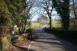
Fother Royd Wood is a woodland in Lancashire, England, near Worsthorne. It covers a total area of 1.03 hectares (2.55 acres). It is owned and managed by the Woodland Trust.
Excerpt from the Wikipedia article Fother Royd Wood (License: CC BY-SA 3.0, Authors).Fother Royd Wood
Hurstwood Lane,
Geographical coordinates (GPS) Address Nearby Places Show on map
Geographical coordinates (GPS)
| Latitude | Longitude |
|---|---|
| N 53.78 ° | E -2.187 ° |
Address
Hurstwood Lane
Hurstwood Lane
BB10 3LF , Worsthorne-with-Hurstwood
England, United Kingdom
Open on Google Maps


