place

Cliviger

Civil parishes in LancashireDistricts in BurnleyUse British English from March 2015Villages in Lancashire
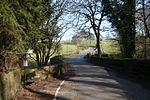
View over Cliviger
View over Cliviger

Cliviger is a civil parish in the Borough of Burnley, in Lancashire, England. It is situated to the southeast of Burnley, and northwest of Todmorden. According to the 2011 census, the parish has a population of 2,238.Although the whole parish lies within the Borough of Burnley it is actually split between three post towns, with a few farms lying in either the Todmorden or Bacup postal areas. Nowadays, it is mainly a dormitory area for people working in Burnley and other towns in East Lancashire and West Yorkshire. Contrary to popular (and in some cases mistaken local) belief there is no village of "Cliviger". The principal settlements within the parish are Walk Mill, Southward Bottom, Overtown, Mereclough and Holme Chapel.

Excerpt from the Wikipedia article Cliviger (License: CC BY-SA 3.0, Authors, Images).

Cliviger
Burnley Road,

Geographical coordinates (GPS) Address Nearby Places
placeShow on map

Wikipedia: ClivigerContinue reading on Wikipedia

Geographical coordinates (GPS)

Latitude Longitude
N 53.765 ° E -2.206 °
placeShow on map

Address

Burnley Road

Burnley Road
BB10 4SN , Cliviger
England, United Kingdom
mapOpen on Google Maps

View over Cliviger
View over Cliviger
Share experience

Nearby Places

Singing Ringing Tree (sculpture)

The Singing Ringing Tree is a wind powered sound sculpture resembling a tree set in the landscape of the Pennine hill range overlooking Burnley, in Lancashire, England. Completed in 2006, it is part of the series of four sculptures within the Panopticons arts and regeneration project created by the East Lancashire Environmental Arts Network (ELEAN). The project was set up to erect a series of 21st-century landmarks, or Panopticons (structures providing a comprehensive view), across East Lancashire as symbols of the renaissance of the area. Designed by architects Mike Tonkin and Anna Liu of Tonkin Liu, the Singing Ringing Tree is a 3-metre (10 ft) tall construction comprising pipes of galvanised steel which harness the energy of the wind to produce a slightly discordant and penetrating choral sound covering a range of several octaves. Some of the pipes are primarily structural and visual elements, while others have been cut across their width enabling the sound. The harmonic and singing qualities of the tree were produced by tuning the pipes according to their length by adding holes to the underside of each. In 2007, the sculpture won (along with 13 other candidates) the National Award of the Royal Institute of British Architects (RIBA) for architectural excellence. In March 2017, a second Singing Ringing Tree was set on the outskirts of Austin, Texas in the United States in the rural area of a small town called Manor. While the exact location is unknown, Tonkin Liu also helped in the creation of a third sculpture which is found somewhere in Saudi Arabia. The "Singing Ringing Tree" sculpture was donated to the City of Abilene in July 2022 by its owner in the Austin, Texas, area. The anonymous donor covered the installation and moving costs, which were arranged by the Abilene Cultural Affairs Council. The council contracted with JK Welding to dismantle and reassemble the sculpture, which is composed of nearly 27 tons of pipes, east of the Frontier Texas! museum in the grassy median where Treadaway Boulevard splits and flows into South 1st St. The sculpture's position has been optimized to maximize the wind blowing across the pipes, taking advantage of wind channeled through two nearby underpasses. However, the sculpture is mostly silent in the Abilene location, with director of the Abilene Cultural Affairs Council admitting that “most [visitors] haven’t heard it yet.” The reason why the tubes have failed to consistently produce noise is unknown.

Towneley Colliery
Towneley Colliery

Towneley Colliery or Towneley Desmesne was a coal mine on the Burnley Coalfield in Burnley, Lancashire, England. Sunk in the late 1860s, it was linked to the Lancashire and Yorkshire Railway's Burnley to Todmorden line which became known as the Copy Pit route and, by tramway, to the Leeds and Liverpool Canal. Towneley Colliery was sunk next to Brooks and Pickup's fireclay works less than a half mile from Towneley railway station which served Towneley Hall. Brooks and Pickup began coal production from the main shaft, the Alice Pit in late February 1869. For 75 years coal was extracted from the Arley, Dandy, King and Yard mines. The colliery had sidings on either side of the Lancashire and Yorkshire Railway's Burnley to Todmorden line, the Copy Pit route. A half-mile long tramway linking it to the Leeds and Liverpool Canal had four tunnels. Boggart Brig Pit beside the A671 Todmorden Road was linked by a tramroad and was also linked underground. The pit was also linked underground to Bank Hall Colliery a half mile distant.In 1923 the colliery was owned by Brooks & Brooks Collieries and employed 770 men working the colliery which included the Towneley Drift. In 1933 the Towneley Coal & Fireclay Company employed 672 men, 480 of them underground. The colliery produced fireclay as well as coal used for household and manufacturing use, coking and for producing gas.The colliery was nationalised in 1947 after which the National Coal Board worked the Yard, Dandy and Lower Mountain mines. Its satellite pits, Dyneley Knoll (53°45′14″N 2°12′47″W), Boggart Brig (53°46′16″N 2°13′41″W) and Park Pits (53°46′19″N 2°12′36″W) closed in 1947 and were abandoned in 1949. The colliery closed on 6 March 1949. Its shafts were used for pumping until 1971 when Bank Hall Colliery closed. Little remains of the colliery, a residential development occupies a small part of the site and the rest comprises steep, mossy hillocks and woodland. A small replica brick kiln was built on a hillock to commemorate the colliery's brickworks.