Briercliffe
Civil parishes in LancashireGeography of Burnley

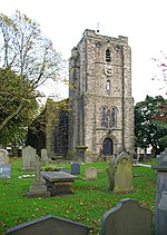
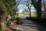
Briercliffe (historically Briercliffe-with-Extwistle) is a civil parish in the borough of Burnley, in Lancashire, England. It is situated 3 miles (4.8 km) north of Burnley. The parish contains suburbs of Burnley (including Harle Syke and Haggate), and the rural area north east of the town. Hamlets in the parish include Cockden, Lane Bottom and in the Extwistle area, the tiny hamlet of Roggerham. According to the United Kingdom Census 2011, the parish has a population of 4,031.The parish adjoins the Burnley parish of Worsthorne-with-Hurstwood and the unparished area of Burnley, the Pendle parishes of Brierfield, Nelson and Trawden Forest and West Yorkshire.
Excerpt from the Wikipedia article Briercliffe (License: CC BY-SA 3.0, Authors, Images).Briercliffe
Todmorden Road,
Geographical coordinates (GPS) Address Nearby Places Show on map
Geographical coordinates (GPS)
| Latitude | Longitude |
|---|---|
| N 53.81 ° | E -2.19 ° |
Address
Todmorden Road
Todmorden Road
BB10 3QQ , Briercliffe
England, United Kingdom
Open on Google Maps


