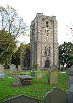
Haggate

Haggate is a small village within the parish of Briercliffe, situated three miles north of Burnley, Lancashire. The village is mostly built around a small crossroads, with routes towards Burnley, Nelson and Todmorden. The first buildings in the village date from the 16th century, when the Hare and Hounds public house, which still stands to this day, was built. The village was first officially documented in the 17th century. The origins of the name Haggate are unclear, although it is thought that it could mean, "the path by the hawthorn trees". The village itself is situated at the top of a hill, 800 feet above sea level. The buildings in the village are predominantly stone-built.As of 2009, Haggate has two public houses, a school and a Baptist church.Haggate has direct road links with Burnley and Nelson, and is served by local bus services (111 and 112) operated by Burnley Bus Company.
Excerpt from the Wikipedia article Haggate (License: CC BY-SA 3.0, Authors, Images).Haggate
Todmorden Road,
Geographical coordinates (GPS) Address Nearby Places Show on map
Geographical coordinates (GPS)
| Latitude | Longitude |
|---|---|
| N 53.813 ° | E -2.195 ° |
Address
Todmorden Road
Todmorden Road
BB10 3QG , Briercliffe
England, United Kingdom
Open on Google Maps


