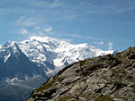
Gonella Hut
Mountain huts in Aosta ValleyMountain huts in the Alps

The Gonella Hut (French: Refuge Francesco Gonella; Italian: Rifugio Francesco Gonella and sometimes called Rifugio del Dôme; or Refuge du Dôme) is a high elevation mountain hut in the Aosta Valley in the Mont Blanc massif area of the Alps. It lies at an elevation of 3071 metres, above Val Veny near Courmayeur in Italy. The refuge is located on the Italian 'normal route' to Mont Blanc.
Excerpt from the Wikipedia article Gonella Hut (License: CC BY-SA 3.0, Authors, Images).Gonella Hut
Sentiero per Rifugio Monzino,
Geographical coordinates (GPS) Address Phone number Website External links Nearby Places Show on map
Geographical coordinates (GPS)
| Latitude | Longitude |
|---|---|
| N 45.819166666667 ° | E 6.8322222222222 ° |
Address
Rifugio Francesco Gonella
Sentiero per Rifugio Monzino
Aosta Valley, Italy
Open on Google Maps
Phone number
CAI
+390165885101;+393395849608;+393404065672


