place

Exchange Place station (PATH)

1909 establishments in New JerseyPATH stations in New JerseyRailway stations in Hudson County, New JerseyRailway stations in the United States opened in 1909Railway stations located underground in New Jersey
Transportation in Jersey City, New JerseyUse mdy dates from November 2017
Exchange Place PATH platform

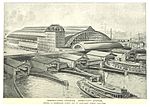
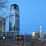
Exchange Place is a station on the Port Authority Trans–Hudson (PATH) rail system in the Paulus Hook neighborhood of Jersey City, Hudson County, New Jersey. The station is on the Newark–World Trade Center line between Newark Penn Station and World Trade Center all week and the Hoboken–World Trade Center line during the day on weekdays to service Hoboken Terminal. Exchange Place provides access to the Jersey City waterfront and a station on the Hudson–Bergen Light Rail, where connections are available to Bayonne and North Bergen. Exchange Place station opened on July 19, 1909 as part of the original opening of the Hudson and Manhattan Railroad between the former Pennsylvania Railroad terminal at Exchange Place and Hudson Terminal. The station headhouse was rebuilt in 1989. Exchange Place station flooded after the September 11 attacks and was closed until June 29, 2003, when it became a temporary terminal. Service returned to World Trade Center on November 23.

Excerpt from the Wikipedia article Exchange Place station (PATH) (License: CC BY-SA 3.0, Authors, Images).

Exchange Place station (PATH)
Exchange Place, Jersey City

Geographical coordinates (GPS) Address Nearby Places
placeShow on map

Wikipedia: Exchange Place station (PATH)Continue reading on Wikipedia

Geographical coordinates (GPS)

Latitude Longitude
N 40.7162 ° E -74.032981 °
placeShow on map

Address

Katyn Memorial

Exchange Place
07302 Jersey City
New Jersey, United States
mapOpen on Google Maps

Exchange Place PATH platform
Share experience

Nearby Places

Hudson Waterfront
Hudson Waterfront

The Hudson Waterfront is an urban area of northeastern New Jersey along the lower reaches of the Hudson River, the Upper New York Bay and the Kill van Kull. Though the term can specifically mean the shoreline, it is often used to mean the contiguous urban area between the Bayonne Bridge and the George Washington Bridge that is approximately 19 miles (31 km) long. Historically, the region has been known as Bergen Neck, the lower peninsula, and Bergen Hill, lower Hudson Palisades. It has sometimes been called the Gold Coast. The municipalities comprising the Hudson Waterfront are Bayonne, Jersey City, Hoboken, Union City, Weehawken, West New York, Guttenberg and North Bergen in Hudson County and Fairview, Cliffside Park, Edgewater and Fort Lee in Bergen County. To the east, lies the New York City boroughs of Manhattan and Brooklyn, to the south Staten Island, to the west Newark Bay and the New Jersey Meadowlands, and to the north the Northern Valley & Palisades Interstate Park. The Hudson River Waterfront Walkway, which includes sections of the East Coast Greenway, travels along the Hudson River. During the Dutch colonial era, the area was under the jurisdiction of New Amsterdam and known as Bergen. Jersey City and Hoboken in Hudson County are sometimes referred to as the sixth borough, given their proximity and connections by PATH trains. Fort Lee, in Bergen County, opposite Upper Manhattan and connected by the George Washington Bridge, has also been called the sixth borough.