South Circular Road, London

The South Circular Road (formally the A205 and often simply called the South Circular) in south London, England, is a major road that runs from the Woolwich Ferry in the east to the Chiswick Flyover in the west via Eltham, Lee Green, Catford, Forest Hill, Dulwich, Tulse Hill, Clapham Common, Clapham Junction, Wandsworth, Putney, Barnes, Mortlake and Kew Bridge. Together with the North Circular Road and Woolwich Ferry, it makes a complete ring-road around Central London. The South Circular is largely a sequence of urban streets joined together, requiring several at-grade turns, unlike the mostly purpose-made carriageways of the North Circular. As a result, it is frequently congested. Originally planned as a new-build route across South London, construction of the first section of the South Circular near Eltham began in 1921 to a high-quality specification. The remainder of the road was supposed to be of a similar standard but it was repeatedly delayed, and the current route was allocated in the late 1930s to existing urban streets instead. Despite several proposals to either upgrade the road or replace it with a parallel motorway, there has been little change in the century since the route was first planned and most of the road is still urban streets. The South Circular has received sustained criticism for congestion and pollution and is one of the least popular roads in Britain.
Excerpt from the Wikipedia article South Circular Road, London (License: CC BY-SA 3.0, Authors, Images).South Circular Road, London
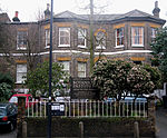
Christchurch Road, London Tulse Hill (London Borough of Lambeth)
Geographical coordinates (GPS) Address Nearby Places Show on map
Geographical coordinates (GPS)
| Latitude | Longitude |
|---|---|
| N 51.4405 ° | E -0.1098 ° |
Address
Christchurch Road / Hillside Road
Christchurch Road
SW2 3DH London, Tulse Hill (London Borough of Lambeth)
England, United Kingdom
Open on Google Maps


