Murphy Oil USA refinery spill

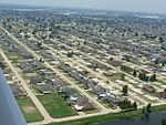
The Murphy Oil USA refinery spill was an oil spill that resulted from the failure of a storage tank at the Murphy Oil USA petroleum refinery in the residential areas of Chalmette and Meraux, Louisiana, United States, on August 30, 2005, the day after Hurricane Katrina made landfall on the U.S. Gulf Coast.On August 29, 2005, the storm surge from the hurricane caused massive failure in the levees along the Mississippi River-Gulf Outlet Canal, inundating St. Bernard Parish with 4 to 14 feet (1.2 to 4.3 m) of water. The Murphy Oil refinery was flooded with 6 to 18 feet (1.8 to 5.5 m) of water, and a 250,000-barrel (40,000 m3) above-ground storage tank at the refinery was dislodged from its moorings and damaged in the flooding. At the time, the tank contained approximately 65,000 barrels (10,300 m3) of mixed crude oil; a breach in the tank's side wall released up to 25,110 barrels (1,055,000 US gal), though the pressure from the floodwaters kept the oil inside of the tank until the waters had receded to about 4 feet (1.2 m), five days after the storm had passed. As the oil was released, it mixed with the floodwaters and flowed from east to west. The spoiled water impacted approximately 1,700 homes in adjacent residential neighborhoods of Chalmette, over an area of about 1 square mile (2.6 km2). Several canals were also impacted, including the 20 Arpent Canal, the 40 Arpent Canal, the Meraux Canal, the Corinne Canal, the DeLaRonde Canal, and various unnamed interceptor canals. According to the U.S. Coast Guard, there were about 44 oil spills in the area affected by Hurricane Katrina, though most occurred in areas of Plaquemines Parish which do not have large populations. The Murphy Oil USA spill was the exception.
Excerpt from the Wikipedia article Murphy Oil USA refinery spill (License: CC BY-SA 3.0, Authors, Images).Murphy Oil USA refinery spill
Fisher Street,
Geographical coordinates (GPS) Address Nearby Places Show on map
Geographical coordinates (GPS)
| Latitude | Longitude |
|---|---|
| N 29.93092 ° | E -89.95979 ° |
Address
Fisher Street
70043
Louisiana, United States
Open on Google Maps


