Slano Blato Landslide

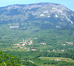
The Slano Blato Landslide (Slovene: plaz Slano blato), or the Salt Mud Slide, is a periodic landslide in Slovenia that is triggered approximately once a century. Although around 8,000 active landslides are present in Slovenia, the Slano Blato Landslide stands out as one of the most serious in terms of the damage it has caused.: 103 The landslide is located on the southern edge of the Trnovo Plateau of the Dinaric Alps, below Mount Čaven and Little Mountain (Mala gora) next to the Platna mountain pasture. It is moving along Grajšček Creek (which also originates in the landslide itself) toward the settlement of Lokavec near Ajdovščina. It is 1,010 to 1,300 metres (3,310 to 4,270 ft) long and 60 to 250 m (200 to 820 ft) wide, covering approximately 15 hectares (37 acres) between the elevations of 360 and 660 m (1,180 and 2,170 ft). Its maximum flow rate was recorded at 100 m (330 ft)/day.
Excerpt from the Wikipedia article Slano Blato Landslide (License: CC BY-SA 3.0, Authors, Images).Slano Blato Landslide
Slano Blato,
Geographical coordinates (GPS) Address Nearby Places Show on map
Geographical coordinates (GPS)
| Latitude | Longitude |
|---|---|
| N 45.913055555556 ° | E 13.865277777778 ° |
Address
Slano Blato
5263
Slovenia
Open on Google Maps


