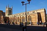
City of Peterborough

The City of Peterborough is a unitary authority district with city status in the ceremonial county of Cambridgeshire, England. The area is named after its largest settlement, Peterborough but also covers a wider area of outlying villages and hamlets. Historically the area was split into parts between the counties of Northamptonshire, Isle of Ely and Huntingdonshire until 1974 when it became part of the short-lived county of Huntingdon and Peterborough before becoming part of the ceremonial county of Cambridgeshire. Located in the East Anglia region of England, the area borders the surrounding counties of Lincolnshire and Northamptonshire. The population of the district was 202,259 making it the second-largest district by population in East Anglia (After Norwich).The district was also part of the Soke of Peterborough and was a Saxon settlement during the Anglo-Saxon era. The district also includes outlying villages such as Thorney, Old Fletton, Werrington, Parnwell, Dogsthorpe, Eye Green, Glinton, Northborough, Maxey, Wittering, Wansford and Ailsworth. The district also forms part of a built up area around the neighbouring settlements of Yaxley, Whittlesey, Alwalton, Crowland and Market Deeping.
Excerpt from the Wikipedia article City of Peterborough (License: CC BY-SA 3.0, Authors, Images).City of Peterborough
Cathedral Square, Peterborough New Fletton
Geographical coordinates (GPS) Address Nearby Places Show on map
Geographical coordinates (GPS)
| Latitude | Longitude |
|---|---|
| N 52.5725 ° | E -0.24305555555556 ° |
Address
Cathedral Square
Cathedral Square
Peterborough, New Fletton
England, United Kingdom
Open on Google Maps


