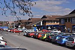
Coity Higher
BridgendCommunities in Bridgend County BoroughGeographic coordinate listsLists of coordinatesWards of Bridgend County Borough
Coity Higher is a community in Bridgend County Borough, south Wales. It contains the north western suburbs of Bridgend which includes the villages of Litchard and Coity. The southern boundary of the community adjoins the community of Brackla, while the northern border is defined by the M4 motorway. Notable buildings and landmarks within the community include Coity Castle, Parc Prison, the 14th century Church of St Mary, Pendre Hospital, Ty Mawr House and a burial chamber. At the 2001 census, the community's population was 835, being re-measured at 6,078 t the 2011 Census.
Excerpt from the Wikipedia article Coity Higher (License: CC BY-SA 3.0, Authors).Coity Higher
Heol West Plas,
Geographical coordinates (GPS) Address Nearby Places Show on map
Geographical coordinates (GPS)
| Latitude | Longitude |
|---|---|
| N 51.521232 ° | E -3.552489 ° |
Address
Heol West Plas
Heol West Plas
CF35 6BH , Coity Higher
Wales, United Kingdom
Open on Google Maps


