place

Walnut Street Bridge (Harrisburg, Pennsylvania)

Bridges completed in 1890Bridges in Harrisburg, PennsylvaniaBridges over the Susquehanna RiverFormer road bridges in the United StatesHistoric American Engineering Record in Pennsylvania
Historic Civil Engineering LandmarksNational Register of Historic Places in Harrisburg, PennsylvaniaPedestrian bridges in PennsylvaniaRoad bridges on the National Register of Historic Places in PennsylvaniaTruss bridges in the United StatesUse mdy dates from June 2022Wrought iron bridges in the United States
Peoples bridge Susquehanna

The Walnut Street Bridge also known as The People's Bridge, is a truss bridge that spanned the Susquehanna River in Harrisburg, Pennsylvania until 1996. Built by the Phoenix Bridge Company in 1890, it is the oldest remaining bridge connecting Harrisburg's downtown and Riverfront Park with City Island. Since flooding in 1996 collapsed sections of the western span, it no longer connects to the West Shore. The bridge was added to the National Register of Historic Places in 1971. A 2014 Cross-River Connections Study notes that the bridge currently serves as an "important bicycle and pedestrian link between City Island and downtown Harrisburg, connecting the city and the Capital Area Greenbelt to special events on City Island."

Excerpt from the Wikipedia article Walnut Street Bridge (Harrisburg, Pennsylvania) (License: CC BY-SA 3.0, Authors, Images).

Walnut Street Bridge (Harrisburg, Pennsylvania)
Walnut Street Bridge, Harrisburg

Geographical coordinates (GPS) Address Nearby Places
placeShow on map

Wikipedia: Walnut Street Bridge (Harrisburg, Pennsylvania)Continue reading on Wikipedia

Geographical coordinates (GPS)

Latitude Longitude
N 40.2575 ° E -76.886 °
placeShow on map

Address

Walnut Street Bridge

Walnut Street Bridge
17101 Harrisburg
Pennsylvania, United States
mapOpen on Google Maps

Peoples bridge Susquehanna
Share experience

Nearby Places

Downtown Harrisburg, Pennsylvania

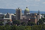
Downtown Harrisburg is the central core neighborhood, business and government center which surrounds the focal point of Market Square, and serves as the regional center for the greater metropolitan area of Harrisburg, Pennsylvania, United States. Harrisburg's downtown Center City comprises the original 80-acre (320,000 m2) borough laid out in a grid pattern by John Harris in 1785. East–west streets are named and north–south streets are numbered. Market Street, running east–west, is the dividing point between north and south street designations.Harrisburg's Central Business District includes the Pennsylvania State Capitol Complex and other state government offices, the Dauphin County Courthouse and other county government offices, City of Harrisburg offices, Pennsylvania State Museum, federal government offices, and other, non-government related commercial retail and office development. Some residential development, both in apartment high-rises and in the upper floors of mixed commercial/residential use buildings, is also located in the downtown area. Downtown is bordered in the northwest by the mixed commercial/residential use Capitol District, in the west by the Susquehanna River, in the southwest by the largely residential Shipoke neighborhood, in the south by Interstate 83, in the east by Amtrak and Norfolk Southern Railway lines, and in the north by Midtown Harrisburg, a mixed-use commercial and residential neighborhood. Forster Street is usually considered the boundary between Downtown and Midtown Harrisburg. City Island, located in the middle of the Susquehanna River directly west of downtown, is typically considered part of Downtown Harrisburg.