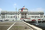
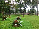
Padre Burgos Avenue

Padre Burgos Avenue, also known as Padre Burgos Street, is a 14-lane thoroughfare in Manila, Philippines. The road was named after Jose Burgos, one of the martyred Gomburza priests who were executed at the nearby Bagumbayan Field (present-day Rizal Park) in 1872. It is a road in the center of the city providing access to several important thoroughfares like Taft Avenue, Rizal Avenue, Roxas Boulevard, and Quezon Boulevard. The avenue is a component of Circumferential Road 1 (C-1) of Metro Manila's arterial road network and National Route 150 (N150) and National Route 170 (N170) of the Philippine highway network. The Manila City Hall can be accessed using this road, as can the Rizal Park and Intramuros.
Excerpt from the Wikipedia article Padre Burgos Avenue (License: CC BY-SA 3.0, Authors, Images).Padre Burgos Avenue
Padre Burgos Avenue, Manila
Geographical coordinates (GPS) Address Nearby Places Show on map
Geographical coordinates (GPS)
| Latitude | Longitude |
|---|---|
| N 14.589166666667 ° | E 120.98055555556 ° |
Address
Club Intramuros Golf Course
Padre Burgos Avenue
1002 Manila (Fifth District)
Philippines
Open on Google Maps


