Rhondda Cynon Taf

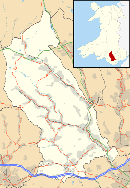
Rhondda Cynon Taf (Welsh pronunciation: [ˈr̥ɔnða ˈkənɔn ˈtaːv], RCT) is a county borough in the south-east of Wales. It consists of five valleys: the Rhondda Fawr, Rhondda Fach, Cynon, Taff (Welsh: Taf) and Ely valleys, plus a number of towns and villages away from the valleys. Results from the 2011 census showed 19.1% of its 234,410 residents self-identified as having some ability in the use of the Welsh language. The county borough borders Merthyr Tydfil County Borough and Caerphilly County Borough to the east, Cardiff and the Vale of Glamorgan to the south, Bridgend County Borough and Neath Port Talbot to the west and Powys to the north. Its principal towns are - Aberdare, Llantrisant with Talbot Green and Pontypridd, with other key settlements/towns being - Maerdy, Ferndale, Hirwaun, Llanharan, Mountain Ash, Porth, Tonypandy, Tonyrefail and Treorchy. The most populous town in Rhondda Cynon Taf is Aberdare (Welsh: Aberdâr) with a population of 39,550 (2011), followed by Pontypridd with 32,694 (2011). The National Eisteddfod will be held at Rhondda Cynon Taf in 2024, postponed twice from 2022.
Excerpt from the Wikipedia article Rhondda Cynon Taf (License: CC BY-SA 3.0, Authors, Images).Rhondda Cynon Taf
Heol Pendyrus,
Geographical coordinates (GPS) Address Nearby Places Show on map
Geographical coordinates (GPS)
| Latitude | Longitude |
|---|---|
| N 51.65 ° | E -3.44 ° |
Address
Heol Pendyrus
Heol Pendyrus
CF43 3RN , Stanleytown
Wales, United Kingdom
Open on Google Maps


