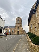
A508 road
All pages needing cleanupGeographic coordinate listsInfobox road instances in the United KingdomInfobox road maps tracking categoryLists of coordinates ... and 5 more
Roads in EnglandTransport in LeicestershireTransport in NorthamptonshireUse British English from January 2013Wikipedia pages needing cleanup from October 2023

The A508 is a 50.961 kilometres (31.666 mi), A-class road for north–south journeys in central and south central England, forming the route from Market Harborough in Leicestershire, via Northampton, to Old Stratford in Northamptonshire, just outside Milton Keynes (and the Buckinghamshire border).
Excerpt from the Wikipedia article A508 road (License: CC BY-SA 3.0, Authors, Images).A508 road
A508,
Geographical coordinates (GPS) Address Nearby Places Show on map
Geographical coordinates (GPS)
| Latitude | Longitude |
|---|---|
| N 52.2675 ° | E -0.9001 ° |
Address
A508
NN2 8DL , Sunnyside
England, United Kingdom
Open on Google Maps


