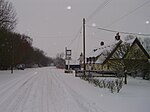
Lambs Lane, Lawshall
Hamlets in SuffolkLawshall

Lambs Lane is a nucleated settlement in the civil parish of Lawshall in the Babergh district in the county of Suffolk, England. In addition to Lambs Lane, the settlement includes The Glebe, Shepherds Drive, Windsor Drive, Churchill Close and Rectory Corner. Melford Road is partly within Lambs Lane and Golden Lane is to the west of the settlement. Lambs Lane is located between Harrow Green, which it almost abuts, and Brockley to the west, and is around one and a half miles off the A134 between Bury St Edmunds and Sudbury.
Excerpt from the Wikipedia article Lambs Lane, Lawshall (License: CC BY-SA 3.0, Authors, Images).Lambs Lane, Lawshall
Lambs Lane, Babergh
Geographical coordinates (GPS) Address Nearby Places Show on map
Geographical coordinates (GPS)
| Latitude | Longitude |
|---|---|
| N 52.16 ° | E 0.711 ° |
Address
Lambs Lane
Lambs Lane
IP29 4NZ Babergh
England, United Kingdom
Open on Google Maps


