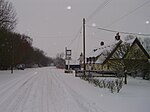
Lawshall

Lawshall is a village and civil parish in Suffolk, England. Located around a mile off the A134 between Bury St Edmunds and Sudbury, it is part of Babergh district. The parish has nine settlements comprising the three main settlements of The Street, Lambs Lane and Bury Road along with the six small hamlets of Audley End, Hanningfield Green, Harrow Green, Hart's Green, Hibb's Green and Lawshall Green. Notable buildings in the parish include All Saints Church and Lawshall Hall. In addition Coldham Hall is very close to the village and part of the grounds of the estate are located within the parish. Other important features include Frithy Wood, which is classified as Ancient Woodland and a designated Site of Special Scientific Interest (SSSI), and The Warbanks historical site.
Excerpt from the Wikipedia article Lawshall (License: CC BY-SA 3.0, Authors, Images).Lawshall
The Street, Babergh
Geographical coordinates (GPS) Address Nearby Places Show on map
Geographical coordinates (GPS)
| Latitude | Longitude |
|---|---|
| N 52.1549 ° | E 0.7248 ° |
Address
The Street
The Street
IP29 4QA Babergh
England, United Kingdom
Open on Google Maps


