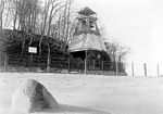
Ferry Point Park

Ferry Point Park is a 413.8-acre (167.5 ha) park in the Bronx, New York City. The park site is a peninsula projecting into the East River roughly opposite the College Point and Malba neighborhoods of Queens. The park is located on the eastern shore of Westchester Creek, adjacent to the neighborhood of Throggs Neck. The park is operated by the New York City Department of Parks and Recreation. The Hutchinson River Expressway (Interstate 678) crosses the park to the Bronx-Whitestone Bridge, splitting it into east and west sides. The east side of the park has a golf course called Trump Ferry Point, a community park, and a waterfront promenade. The east side borders are Saint Raymond's Cemetery; Balcom Avenue, Miles Avenue and Emerson Avenue; and the East River and the Bronx-Whitestone Bridge. The west side is heavily used for soccer, cricket, fishing and barbecues. Friends of Ferry Point Park holds cleanup events, plantings and helps care for the 3,000 trees planted in the park as the Ferry Point 9/11 Memorial Grove and 9/11 Living Memorial Forest. These trees were donated by the Prince of Monaco.
Excerpt from the Wikipedia article Ferry Point Park (License: CC BY-SA 3.0, Authors, Images).Ferry Point Park
Hutchinson River Expressway, New York The Bronx
Geographical coordinates (GPS) Address Nearby Places Show on map
Geographical coordinates (GPS)
| Latitude | Longitude |
|---|---|
| N 40.813 ° | E -73.833 ° |
Address
Trump Links at Ferry Point
Hutchinson River Expressway
10473 New York, The Bronx
New York, United States
Open on Google Maps


