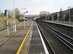
Hextable
AC with 0 elementsEngvarB from July 2016Sevenoaks DistrictVillages in Kent

Hextable is a village and civil parish in the Sevenoaks District of Kent, England. It lies 2 miles (3.2 km) north of Swanley and 4 miles (6.4 km) south of Dartford.
Excerpt from the Wikipedia article Hextable (License: CC BY-SA 3.0, Authors, Images).Hextable
Main Road,
Geographical coordinates (GPS) Address Nearby Places Show on map
Geographical coordinates (GPS)
| Latitude | Longitude |
|---|---|
| N 51.4113 ° | E 0.1819 ° |
Address
Main Road
BR8 7RB , Hextable
England, United Kingdom
Open on Google Maps


