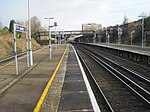
Swanley
Civil parishes in KentEngvarB from June 2016Sevenoaks DistrictSwanleyTowns in Kent

Swanley is a town and civil parish in the Sevenoaks District of Kent, England, 16 miles (26 km) southeast of central London, adjacent to the Greater London boundary and within the M25 motorway periphery. The population at the 2011 census was 16,226.
Excerpt from the Wikipedia article Swanley (License: CC BY-SA 3.0, Authors, Images).Swanley
Nightingale Way,
Geographical coordinates (GPS) Address Nearby Places Show on map
Geographical coordinates (GPS)
| Latitude | Longitude |
|---|---|
| N 51.395 ° | E 0.175 ° |
Address
Nightingale Way
Nightingale Way
BR8 9BA , High Firs
England, United Kingdom
Open on Google Maps


