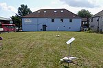
Ramsden, Orpington
Buildings and structures in the London Borough of BromleyDistricts of the London Borough of BromleyHousing estates in LondonOrpingtonPublic housing in the United Kingdom

Ramsden is an area in south-east London, generally considered a suburb of Orpington, located in the London Borough of Bromley and the historic county of Kent. It is situated south of Derry Downs and St Mary Cray, east of Orpington town centre and north of Goddington. It was built as a council estate in the 1950-60s and is directly adjacent to the London Green Belt.
Excerpt from the Wikipedia article Ramsden, Orpington (License: CC BY-SA 3.0, Authors, Images).Ramsden, Orpington
Eldred Drive, London Ramsden
Geographical coordinates (GPS) Address Nearby Places Show on map
Geographical coordinates (GPS)
| Latitude | Longitude |
|---|---|
| N 51.373982 ° | E 0.116935 ° |
Address
Martin's
Eldred Drive 33-35
BR5 4PE London, Ramsden
England, United Kingdom
Open on Google Maps


