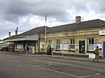
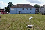
Orpington
Areas of LondonDistricts of the London Borough of BromleyFormer civil parishes in LondonFormer civil parishes in the London Borough of BromleyMajor centres of London ... and 3 more
OrpingtonUse British English from September 2015Vague or ambiguous time from September 2020

Orpington is a town and area in south east London, England, within the London Borough of Bromley. It is 13.4 miles (21.6 km) south east of Charing Cross. On the south-eastern edge of the Greater London Built-up Area, it is south of St Mary Cray, west of Ramsden, north of Goddington and Green Street Green, and east of Crofton and Broom Hill. Orpington is covered by the BR postcode area. It is identified in the London Plan as one of 35 major centres in Greater London.
Excerpt from the Wikipedia article Orpington (License: CC BY-SA 3.0, Authors, Images).Orpington
High Street, London Goddington
Geographical coordinates (GPS) Address Nearby Places Show on map
Geographical coordinates (GPS)
| Latitude | Longitude |
|---|---|
| N 51.3741 ° | E 0.0986 ° |
Address
McDonald's
High Street 291-293
BR6 0NN London, Goddington
England, United Kingdom
Open on Google Maps


