place

Gorman, Maryland

Census-designated places in Garrett County, MarylandNorthwestern TurnpikePopulated places on the North Branch Potomac RiverWestern Maryland geography stubs
Bayard Gormania,WV
Bayard Gormania,WV

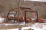
Gorman is a census-designated place (CDP) along the North Branch Potomac River in southern Garrett County, Maryland, United States. As of the 2010 census, Gorman's population was 106. Gorman lies on Gorman Road (Maryland Route 560) off the Northwestern Turnpike (U.S. Route 50), which crosses the North Branch into Gormania, West Virginia, via Gormania Bridge. Like Gormania, the town is named for United States Senator from Maryland, Arthur Pue Gorman (March 11, 1839 – June 4, 1906).

Excerpt from the Wikipedia article Gorman, Maryland (License: CC BY-SA 3.0, Authors, Images).

Gorman, Maryland
George Washington Highway,

Geographical coordinates (GPS) Address Nearby Places
placeShow on map

Wikipedia: Gorman, MarylandContinue reading on Wikipedia

Geographical coordinates (GPS)

Latitude Longitude
N 39.292777777778 ° E -79.352777777778 °
placeShow on map

Address

George Washington Highway

George Washington Highway
27267
Maryland, United States
mapOpen on Google Maps

Bayard Gormania,WV
Bayard Gormania,WV
Share experience

Nearby Places

Garrett County, Maryland

Garrett County () is the westernmost county of the U.S. state of Maryland completely within the Appalachian Mountains. As of the 2020 census, the population was 28,806, making it the third-least populous county in Maryland. Its county seat is Oakland. The county was named for John Work Garrett (1820–1884), president of the Baltimore and Ohio Railroad. Created from Allegany County in 1872, it was the last county to be formed in the state. The county is part of the Western Maryland region of the state. Garrett County is bordered by four West Virginia counties and to the north the Maryland–Pennsylvania boundary known as the Mason–Dixon line. The eastern border with Allegany County was defined by the Bauer Report, submitted to Governor Lloyd Lowndes, Jr. on November 9, 1898. The Potomac River and State of West Virginia lie to the south and west. Garrett County lies in the Allegheny Mountains, which here form the western flank of the Appalachian Mountain Range. Hoye-Crest, a summit along Backbone Mountain, is the highest point in Maryland at an elevation of 3,360 feet (1,020 m). The Eastern Continental Divide runs along portions of Backbone Mountain. The western part of the county, drained by the Youghiogheny River, is the only part of Maryland within the Mississippi River drainage basin. All other parts of the county are in the Chesapeake Bay basin. The National Register of Historic Places listings in Garrett County, Maryland has 20 National Register of Historic Places properties and districts, including Casselman Bridge, National Road a National Historic Landmark. Garrett County is part of Maryland's 6th congressional district. The extreme south of the county lies within the United States National Radio Quiet Zone.