Babilonie

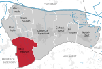
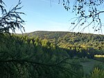
The Babilonie is a hillfort of the La Tène culture at a height of 255.6 metres above sea level on the northern edge of a rounded hill in the Wiehen Hills above the Lübbecke village of Obermehnen in the district of Minden-Lübbecke in the German state of North Rhine-Westphalia. The name is derived from the Germanic baben in the lon i.e. "up in the woods". The wedge-shaped, double-rampart system, which descends from south to north with the slope, was investigated archaeologically in the first half of the last century, especially by Friedrich Langewiesche, who assessed it as a refuge castle. Ceramic and even metalwork finds indicate that it belongs to the La Tène culture in the pre-Roman Iron Age, e vorrömische Eisenzeit, therefore probably part of an extensive trading network. The fortification has an area of over 12 hectares. The first mapping of this hilltop, which was exceptionally well-suited to the establishment of a large hillfort with its spring high up the hills, was carried out after 1880.Ceramic finds from the Saxon-Frankish period have also been discovered. According to Paul Höfer there is a legend that refers to Wittekind.
Excerpt from the Wikipedia article Babilonie (License: CC BY-SA 3.0, Authors, Images).Babilonie
Babilonieweg,
Geographical coordinates (GPS) Address Nearby Places Show on map
Geographical coordinates (GPS)
| Latitude | Longitude |
|---|---|
| N 52.27667 ° | E 8.57667 ° |
Address
Babilonieweg
32312 , Obermehnen
North Rhine-Westphalia, Germany
Open on Google Maps


