Lübbecke Loessland
Bad EssenLübbeckeMindenPreußisch OldendorfRegions of North Rhine-Westphalia ... and 1 more
Wiehen Hills

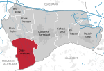
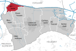
The Lübbecke Loessland (German: Lübbecker Lößland) is a natural region that is mainly situated in northeastern North Rhine-Westphalia but with a small area also lying in the western part of Lower Saxony in Germany. It is a belt of land, covered by loess, about 2 to 5 km wide and around 35 km long, that lies just north of the eastern part of the Wiehen Hills. The total area of the region is about 100 km2. The Lübbecke Loessland is a transitional region between the North German Plain and the Central Uplands. To the north it borders on the Rahden-Diepenau Geest and, to the east, on the Middle Weser Valley. The town of Lübbecke lies in the centre of the region.
Excerpt from the Wikipedia article Lübbecke Loessland (License: CC BY-SA 3.0, Authors, Images).Lübbecke Loessland
Geographical coordinates (GPS) Address Nearby Places Show on map
Geographical coordinates (GPS)
| Latitude | Longitude |
|---|---|
| N 52.297562 ° | E 8.560581 ° |
Address
32312 , Obermehnen
North Rhine-Westphalia, Germany
Open on Google Maps


