place

Wartturm (Lübbecke)

1857 establishments in PrussiaLübbeckeObservation towers in North Rhine-WestphaliaTowers completed in 1857Watchtowers in Germany
Wiehen Hills
Falk Oberdorf Warturm bei LK

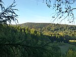
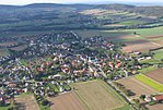
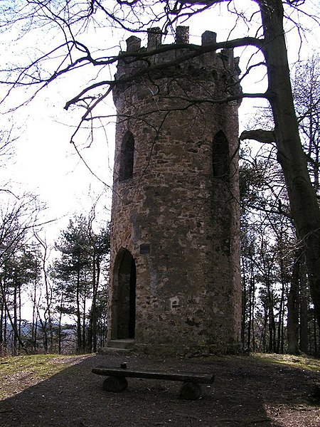
The Wartturm ("watchtower") is an observation tower in the Wiehen Hills on the Wurzelbrink, a wooded hill that, at 319 metres, is the second highest in this hill range. The tower stands on the territory of the town of Lübbecke. The stone tower was built in 1857 by the barons (Freiherrn) of Bussche-Münch from Benkhausen and was completely renovated in 1996. The tower was erected in response to the increasing gymnastics and hiking movement in Germany at that time. During the Nazi era and the Second World War the tower acted for a time as a training area for the Hitler Youth as well as an observation point, for which purpose it had been increased in height by the addition of a wooden superstructure. In 1986 a radio competition took place at the Wartturm. In the early to mid-1980s a very high transmission mast stood next to the tower, that was significantly higher than the tower itself and, unlike the Wartturm, could be clearly seen from Lübbecke. The uninformed often say that the tower is linked to the medieval castle of Reineberg because of its castle-like appearance but are then often surprised to find that it is a product of the Modern Age.The Wartturm has since become the landmark of the traditional Wartturm Run (Wartturmlauf). This fun run takes place annually in June, beginning in the centre Lübbecke, is 13.9 kilometres long and climbs a total height of 346 metres.

Excerpt from the Wikipedia article Wartturm (Lübbecke) (License: CC BY-SA 3.0, Authors, Images).

Wartturm (Lübbecke)
Neuer Kirchweg,

Geographical coordinates (GPS) Address External links Nearby Places
placeShow on map

Wikipedia: Wartturm (Lübbecke)Continue reading on Wikipedia

Geographical coordinates (GPS)

Latitude Longitude
N 52.282885 ° E 8.615078 °
placeShow on map

Address

Wartturm

Neuer Kirchweg
32312 , Obernfelde
North Rhine-Westphalia, Germany
mapOpen on Google Maps

linkWikiData (Q2550033)
linkOpenStreetMap (299143698)

Falk Oberdorf Warturm bei LK
Share experience

Nearby Places

Mensinger Ravine

The Mensinger Ravine (German: Mensinger Schlucht) is a steep-sided valley in the Wiehen Hills in Central Germany that is situated on the territory of the town of Lübbecke in the district of Minden-Lübbecke. The ravine begins on the eastern slopes of the Wurzelbrink hill and runs northwards from there in a curve as far as the B 239 federal road. The ravine is around 800 metres long. The valley floor in its upper section lies at a height of around 210 m above NN and drops to 150 m above NN at the end of the valley, where the source of the Ronceva stream is found. In the ravine itself, although it was formed by erosive influences, there is no permanent stream - only during heavy rainfall at the "upper reaches of the Ronceva", so to speak, does any water flow. The valley floor itself is impassable on foot in places. However, immediately to the east is a forest track, that enables the valley to be walked from end to end in 15 minutes. The ravine is forested throughout. The Mensinger Ravine is a typical example of a Siepe, a narrow, wet, ravine-like, V-shaped valley in higher hills or low mountains with a source stream. (in the East Westphalian region of Ravensberg Land and in the Lipperland such a terrain feature is known as a Siek). The source streams in such a valley do not necessarily carry water all-year round, as in the case of that in the Mensiger Ravine, however, the stream is the reason the V-shaped valley was formed. It must however be taken into account for terrain shaping, that in the post ice age the water levels flowing out of the mountain ranges, including the Wiehen, were greater, so that streams were able to cut into the terrain much more than they do today. This is the reason the ravine is so deep despite the rather low levels of water flow on the ravine floor today.

Heidbrink
Heidbrink

The Heidbrink is a hill which lies south of Lübbecke in central Germany and, at 319.6 m above sea level (NN), is the highest peak in the Wiehen Hills. It is also the highest elevation in the district of Minden-Lübbecke in the German state of North Rhine-Westphalia. Its height is commonly given as 320 metres. About 200 yards east of the summit is a transmission tower for television and radio links and a wayside hut for walkers. The mast has a paved access road from the B 239. The summit of the Heidbrink itself is in a small open area and, until 2008, was marked by a boulder. Due to the surrounding high trees the view is blocked to the north; to the south can parts of the Ravensberg Basin be seen. The Ronceva rises on the western slope of the mountain. To the north are the peaks of the Reineberg, 276 m above sea level, and the Heidkopf, 273 m. The southern flank of the mountain drops steeply to the hamlet of Ahlsen-Reineberg in the municipality of Hüllhorst. The ridgeway (Kammweg) passes over the top of the mountain. It forms the boundary between the town of Lübbecke and the municipality of Hüllhorst. The ridgeway runs as a footpath (the Wittekindsweg) along the Wiehen ridge from Osnabrück to Porta Westfalica, and links the Heidbrink with the Straußberg (276 m) in the east, and the Horsthöhe (275 m) and Kniebrink (315 m) in the west. To mark the highest point on the Heidbrink a five-ton sandstone block with strong iron deposits, typical of the local Wiehen Hills, was set up on 24 May 2008. According to information boards by the TERRA.vita Nature Park, members of the Lübbecke marketing association (Stadtmarketingverein) and the municipal curator of Hüllhorst have marked the route to the "highest stone" with their own symbol. These are sometimes signposts, sometimes coloured markings, on wayside tree trunks. The symbol, the letter "H" on a hill symbol, is meant to be linked with the name and the appearance of the hill. At the new summit stone are two tablets; the upper one describes the Heidbrink as the highest hill in the Wiehen range; the lower panel lists the sponsors of this marketing campaign. The new summit stone is not in the same place as the old and rather less imposing summit stone, but about 20 metres east. The original stone was removed during the work to set up the new one. But it appears that the original spot had marked the exact peak, but was not so obviously recognisable from the main footpath.