Buckland, Oxfordshire
Civil parishes in OxfordshireUse British English from August 2015Villages in Oxfordshire

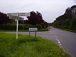
Buckland is a village and large civil parish about 4 miles (6.4 km) northeast of Faringdon in the Vale of White Horse District. Buckland was part of Berkshire until the 1974 boundary changes transferred it to Oxfordshire. The 2011 Census recorded the parish's population as 588. Outside the village the civil parish includes the small settlements of Carswell and Barcote to the west, Buckland Marsh to the north, and the modern development of Gainfield on the southern boundary.
Excerpt from the Wikipedia article Buckland, Oxfordshire (License: CC BY-SA 3.0, Authors, Images).Buckland, Oxfordshire
Vale of White Horse
Geographical coordinates (GPS) Address Nearby Places Show on map
Geographical coordinates (GPS)
| Latitude | Longitude |
|---|---|
| N 51.679 ° | E -1.506 ° |
Address
SN7 8QN Vale of White Horse
England, United Kingdom
Open on Google Maps


