Tide Cove
Bays of Hong KongCovesHong Kong geography stubsSha Tin District

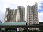
Sha Tin Hoi / Sha Tin Sea (Chinese: 沙田海; Jyutping: saa1 tin4 hoi2; pinyin: Shātián Hǎi) or Tide Cove is a cove at the mouth of the Shing Mun River. It is between Ma Liu Shui and Ma On Shan. The cove is open to Tolo Harbour (Tai Po Hoi). It was largely reclaimed for the development of Sha Tin New Town. Tide Cove may shrink further in the future, as the government is exploring further land reclamation at Ma Liu Shui.
Excerpt from the Wikipedia article Tide Cove (License: CC BY-SA 3.0, Authors, Images).Tide Cove
Ning Tai Road, Sha Tin District Tai Shui Hang
Geographical coordinates (GPS) Address Nearby Places Show on map
 Continue reading on Wikipedia
 Geographical coordinates (GPS)
| Latitude | Longitude |
|---|---|
| N 22.416944444444 ° | E 114.21916666667 ° |
Address
Ning Tai Road
Sha Tin District, Tai Shui Hang
Hong Kong, China
Open on Google Maps