place

Scottow

Civil parishes in NorfolkNorfolk geography stubsNorth NorfolkVillages in Norfolk
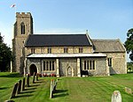
Scottow War Memorial geograph.org.uk 615774

Scottow is a village and civil parish in the English county of Norfolk. It is located some 2.5 miles north of Coltishall and 5 miles south of North Walsham. The villages name means 'Scots' hill-spur'.The civil parish has an area of 8.59 km2 (3.32 sq mi) and in 2001 had a population of 1,774 in 357 households, the population decreasing to 1,424 at the 2011 Census. For the purposes of local government, the parish falls within the district of North Norfolk.Most of the former Royal Air Force Coltishall military airbase lay within the parish boundaries of Scottow. Today, part of the RAF base has been converted into HMP Bure, a prison for adult males, and the rest has been used to create Scottow Enterprise Park focused on helping businesses to grow through providing space in the form of offices and workshops, as well as business support.

Excerpt from the Wikipedia article Scottow (License: CC BY-SA 3.0, Authors, Images).

Scottow
The Fairstead, North Norfolk Scottow

Geographical coordinates (GPS) Address Nearby Places
placeShow on map

Wikipedia: ScottowContinue reading on Wikipedia

Geographical coordinates (GPS)

Latitude Longitude
N 52.761 ° E 1.37626 °
placeShow on map

Address

The Fairstead

The Fairstead
NR10 5AQ North Norfolk, Scottow
England, United Kingdom
mapOpen on Google Maps

Scottow War Memorial geograph.org.uk 615774
Share experience

Nearby Places

Little Hautbois

Little Hautbois is a small hamlet in Broadland, England, part of the parish of Lamas. The name is pronounced 'Hobbis', and can be seen thus spelled on a memorial on the outside of nearby Lamas Church. The population of the hamlet is included in the civil parish of Buxton with Lamas. In the Middle Ages, the settlement of Great Hautbois was the head of the navigation on the River Bure, and it is thought Little Hautbois developed from that. The name, which can be translated to "High Woods" in English, is taken from that of the de Alto Bosco, or de Haut Bois, family, who acquired these lands at the Norman Conquest (alternatively, they may have taken the name from the settlement, Blomefield being uncertain on this point. As of 2007, Little Hautbois consisted of eight dwelling-houses, one a holiday cottage rented out by the owner. The church of Little Hautbois, once owned by the monks of St Benet's Abbey, fell into ruin in the 15th century when the parish was amalgamated with that of Lamas. Although ruins were still visible in the 18th century, no sign of the building now remains above ground; the only trace of its existence is a depression in the grounds of Hautbois Hall. Little Hautbois has the feel of an isolated rural community now, but two former main transport routes pass through it: the River Bure, canalised in the 18th century to allow navigation up to Aylsham, and the Bure Valley Railway, now a light steam railway but formerly a full-sized railway.