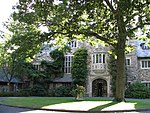
Ringwood Mines landfill site
The Ringwood Mines landfill site is a 500 acres (200 ha) former iron mining site located in the borough of Ringwood, New Jersey. From 1967 to 1980, the Ford Motor Company dumped hazardous waste on this land, which negatively affected the health and properties of Ramapough Mountain Indians. This led to Mann V. Ford, a 1997 lawsuit between Ramapough Lenape Tribe's lawsuit of the Ford Motor Company. Used in the late 1960s and early 1970s by the large Ford Motor Company plant in nearby Mahwah, New Jersey for disposal of waste, it was identified by the Environmental Protection Agency (EPA) for its Superfund priority list in 1984 for cleanup of hazardous wastes. EPA deleted the site from the Superfund list in 1994 but subsequently relisted the site several times due to failed environmental remediation. Portions of the landfill site were repurposed as land used for affordable housing for the Ramapough people in the 1970s, even though the land was contaminated. The plant closed in 1980. EPA found additional pockets of paint sludge in 1995, 1998 and in 2004; it directed Ford to do additional cleanup. In 2005, the Bergen Record did a five-part investigative series, Toxic Legacy, on the site and found extensive contamination in the nearby residential community. EPA confirmed the area was contaminated with industrial and hazardous waste and placed the site back on the Superfund priority list in 2006. It is part of the watershed for 2.5 million people in New Jersey. Part of the 500 acres (200 ha) site extends into Ringwood State Park, as Ford had donated five acres of the former Peters Mine Pit site to the state, which absorbed it into the park. By 2011, an additional 47,000 tonnes (104,000,000 lb) of contaminated earth has been removed from the site, five times as much as had been removed under the earlier cleanup in the 1980s and 1990s.
Excerpt from the Wikipedia article Ringwood Mines landfill site (License: CC BY-SA 3.0, Authors).Ringwood Mines landfill site
Cable House Road,
Geographical coordinates (GPS) Address Nearby Places Show on map
Geographical coordinates (GPS)
| Latitude | Longitude |
|---|---|
| N 41.1427 ° | E -74.2692 ° |
Address
Cable House Road
Cable House Road
07456
New Jersey, United States
Open on Google Maps


