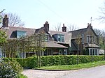
Newton Valence
Newton Valence is a village and civil parish in the East Hampshire district of Hampshire, England. It is 4.4 miles (7.1 km) south of Alton, just off the A32 road. The nearest railway station is Liss, 4.5 miles (7.3 km) southeast of the village, although the station at Alton is a similar distance to the north. The village sits high in the westernmost chalk hills of the South Downs: maximum elevation 191 metres (627 feet) above sea level. Much of the surrounding landscape is within the East Hampshire Area of Outstanding Natural Beauty. Farming is the most obvious economic activity. Arable farming (mainly wheat, maize and oil-seed rape) and sheep-grazing predominate.
Excerpt from the Wikipedia article Newton Valence (License: CC BY-SA 3.0, Authors).Newton Valence
Newton Lane, East Hampshire Newton Valence
Geographical coordinates (GPS) Address Nearby Places Show on map
Geographical coordinates (GPS)
| Latitude | Longitude |
|---|---|
| N 51.08897 ° | E -0.96848 ° |
Address
Newton Lane
Newton Lane
GU34 3RE East Hampshire, Newton Valence
England, United Kingdom
Open on Google Maps


