Walmsgate
Deserted medieval villages in LincolnshireEast Lindsey DistrictHamlets in LincolnshireUse British English from November 2014

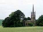
Walmsgate is a hamlet in the civil parish of Burwell, in the East Lindsey district of Lincolnshire, England. It is situated on the A16 road, 6 miles (10 km) south-east from Louth. The name 'Walmsgate' means 'point of land of a man named Waldmaer'.The lost village of Walmsgate is mentioned in 1377. A priest was last instituted about 1435, and eight families remained in 1563. The small church was still standing in the early 17th century. The walls of the church still stand to a maximum height of 6 feet (1.8 m) and are covered with a dense growth of ivy. The limestone ruins of the church are Grade II listed.
Excerpt from the Wikipedia article Walmsgate (License: CC BY-SA 3.0, Authors, Images).Walmsgate
London Road, East Lindsey
Geographical coordinates (GPS) Address Nearby Places Show on map
Geographical coordinates (GPS)
| Latitude | Longitude |
|---|---|
| N 53.284499 ° | E 0.045612 ° |
Address
London Road
London Road
LN11 8QN East Lindsey
England, United Kingdom
Open on Google Maps


