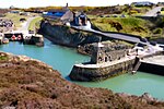
Llaneilian

Llaneilian (Welsh: [ɬanˈei̯ljan]) is a village and community in Anglesey, Wales. It is located in the north east of the island, 2.2 miles (3.5 km) east of Amlwch, 16.5 miles (26.6 km) north west of Menai Bridge and 12.5 miles (20.1 km) north of Llangefni. The community includes the villages and hamlets of Dulas, Llaneilian, Pengorffwysfa, Cerrig Man and Penysarn, Gadfa and Nebo, and at the 2001 census had a population of 1,192, decreasing slightly to 1,186 at the 2011 Census. The parish is crowned by its hill, Mynydd Eilian (177 metres), a HuMP, popular with walkers and ramblers (the Anglesey Coastal Path navigates most of the parish's coastline - all of which within the Anglesey Coastal Area of Outstanding Natural Beauty), and its beach, Traeth Eilian, which is popular with holidaymakers and for watersport activities. At the north easternmost point is Point Lynas, (on a clear day from the north coast of Anglesey the Isle of Man is visible with the streetlights of Douglas, Isle of Man visible on the horizon), while Ynys Dulas lies off the North East coast of the island, east of Dulas Bay.
Excerpt from the Wikipedia article Llaneilian (License: CC BY-SA 3.0, Authors, Images).Llaneilian
Geographical coordinates (GPS) Address Nearby Places Show on map
Geographical coordinates (GPS)
| Latitude | Longitude |
|---|---|
| N 53.407 ° | E -4.296 ° |
Address
LL68 9LU
Wales, United Kingdom
Open on Google Maps


