place

Grandborough

Borough of RugbyCivil parishes in WarwickshireVillages in Warwickshire
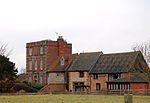
Grandborough Main Street geograph.org.uk 1331775

Grandborough is a small village and civil parish in the Rugby district, in the county of Warwickshire, England. The parish includes the hamlets of Calcutt, Grandborough Fields and Woolscott. The population of the civil parish at the 2011 census was 424. Grandborough is in a rural area of eastern Warwickshire, around six miles (10 km) south of Rugby and six miles northwest of Daventry, Northamptonshire. Grandborough is about two miles from the nearest main roads and can be reached by country lanes from the A45 to the east, and the A426 to the west. The River Leam flows north of the village. There was a watermill (now a private residence) where the river passed under the road from Woolscott. In times of flood, the river flows over the road creating a ford. A road sign suggests that pedestrians and motorists should "Use causeway if flooded". Grandborough's church is dedicated to St Peter. The church spire, and the two tall Wellingtonia trees which flank it, are notable local landmarks. There is also a Primitive Methodist chapel (erected in 1856, extended in 1991, but closed in November 2021), a village hall (the Benn Memorial Hall, erected in 1897) and a number of old (mostly Victorian) cottages. The village has a pub called the Shoulder of Mutton. In Main Street there is a private house which was formerly a pub called the Royal George. Harrow House, in Woolscott, was formerly a pub called the Old Harrow Inn.

Excerpt from the Wikipedia article Grandborough (License: CC BY-SA 3.0, Authors, Images).

Grandborough
Church Road,

Geographical coordinates (GPS) Address Nearby Places
placeShow on map

Wikipedia: GrandboroughContinue reading on Wikipedia

Geographical coordinates (GPS)

Latitude Longitude
N 52.298983 ° E -1.27917 °
placeShow on map

Address

Church Road
CV23 8DH
England, United Kingdom
mapOpen on Google Maps

Grandborough Main Street geograph.org.uk 1331775
Share experience

Nearby Places

Kites Hardwick
Kites Hardwick

Kites Hardwick is a hamlet in east Warwickshire, England, in the Leam Valley ward of Rugby Borough and in the civil parish of Leamington Hastings The village straddles the A426 Rugby to Southam road two miles (3 km) south of Dunchurch. It lies in the valley of the River Leam which passes under the A426 at Thurlaston Bridge, just north of Kites Hardwick. This spot was the location of frequent flooding of the road until in 2001 the Environment Agency constructed a gauging station immediately west of the bridge with associated works to ease the flow of the river.Kites Hardwick takes the second part of its name from the Herdewyk family (who are mentioned in the Domesday Book and throughout the late Middle Ages): there are numerous references to the family (also spelled Herdwych and Herdewic) in medieval records from the midlands of England. It is less clear where the first part of the village's name originates but it may refer to red kites, a bird of prey common in England until the 19th century. Kites Hardwick was a manor in its own right, separate from the manor of Leamington Hastings. The first mention of the manor is in 1236, when Robert Hastang (whose family gives the name to Leamington Hastings) went to law against William de Herdewic regarding customs and services owed. By the 16th century, the manor was known as Hardwick Grimbald.Leamington Hastings parish is entirely rural farming and Kites Hardwick remains an agricultural settlement. According to L. F. Salzman's History of the County of Warwick an early-17th-century document states: The glebe land of Ougham and Westcroft (in Kites Hardwick) was capable of supporting 10 milch cows besides 'rearers' and two or three hundred sheep, and also contained 4 yard land of corn and hay Today, there is a mix of livestock (mostly sheep) and arable farming. However, Salzman records that much of the arable land had once been pasture; this seems borne out as late as 1853 in a reference by RS Surtees to: ... the wide-stretching grazing grounds of Southam and Dunchurch.A ewe from the Manor Farm flock of Southdown sheep won Reserve Supreme Champion for Kites Hardwick farmer John Goode at the Royal Show at Stoneleigh in 2000. Manor Farm is on the east side of the A426 road and is architecturally the most notable of the farms in the village. The house is a three-storey early Georgian red brick house with stone dressings and has been Grade II listed since December 1951. Kites Hardwick is served by a bus service running between Rugby and Leamington Spa although most residents have cars. The speed limit through the village was 60 mph but was recently reduced to 50 mph although, unusually, the police objected to the lowering of the limit. A golf driving range was constructed on agricultural land just north of the village in 1992. It now operates as Leam Valley Golf Centre and provides a 14-bay range which is floodlit at night, a nine-hole golf course and putting greens.Draycote Water lies north of the village. It is operated by Severn Trent Water as a domestic water storage reservoir. It was opened in 1970 and holds up to 5,000,000,000 imperial gallons (22,700,000 m3) of water. The reservoir sits beside and above the River Leam and water is pumped up from the river during the winter. Draycote supplies nearby Rugby by pipe and can also feed water back into the River Leam to supply the Leamington Spa area. There is a visitor centre, a sailing club and the reservoir is popular with walkers, birdwatchers and anglers. Kites Hardwick was once more of village status, with 3 pubs. They drank beer because of the lack of clean water. It is said that the people of Kites Hardwick were very drunk. The people who lived there were wiped out by the Black Death (the plague) in the 15th century. Kites Hardwick is also known as Kytes Hardwick.

Bilton Grange
Bilton Grange

Bilton Grange is a preparatory school located in Dunchurch, near Rugby, Warwickshire. The present headmaster is Gareth Jones. The mansion which forms the main school was built in 1846 attached to an existing farmhouse and was a private family home. It was designed by the eminent designer and architect Augustus Welby Pugin for Captain Washington Hibbert, and is a Grade II* listed building. The first pupils were brought to the house by The Reverend Walter Earle in 1887. The brewhouse was converted into the school chapel in 1889 and classrooms were added in 1892. The school formally amalgamated with the neighboroughing Homefield Girls' School, with which it had long had a connection, in 1992 with Bilton Grange becoming co-educational and the Homefield School building becoming the Pre-Prep department for children aged 4 to 8. Bilton Grange has always been a boarding school but in more recent times has accommodated an increasing number of day children, many of whom take advantage of the opportunity to flexi board and become weekly or full boarders during their time at Bilton Grange. The school enjoys an estate of over 90 acres including several areas of woodland and a 9-hole golf course laid out in 1998. The designed the library and a staircase leading to the boarding house. The four Sections (Bilton's name for houses) are Cheadle, Westminster, Alton and Oxburgh. Bilton Grange is commonly recognised as the feeder to Rugby School although over half of each leaving yeargroup of 13-year-olds go on to other public schools such as Uppingham School, Eton College and Oundle School. In September 2019 the school announced that it was merging with Rugby School as one charity, but remaining a separate, autonomous school, with children still able to progress to a range of public schools.