place

Lower Shuckburgh

Former civil parishes in WarwickshireStratford-on-Avon DistrictVillages in Warwickshire
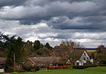
Lower Shuckburgh from the south geograph.org.uk 1257448

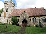
Lower Shuckburgh is a small village and former civil parish, now in the parish of Upper and Lower Shuckburgh, (which in the 2001 census had a population of 82) in the Stratford-on-Avon district, in eastern Warwickshire, England. In 1961 the parish had a population of 74. On 1 April 1988 the parish was abolished to form "Upper and Lower Shuckburgh".The village lies on the A425 road between Southam and Daventry. Just north of the village is the Oxford Canal. On Beacon Hill, just south of the village, is the deserted village of Upper Shuckburgh after which the parish is partly named. The most notable buildings in the village are the Church of St John the Baptist, designed by John Croft, which dates from 1864 and is built in Gothic style, and Shuckburgh Hall, a privately owned country house mansion, which has been the home of the Shuckburgh family since the 12th century. The 15 feet (5 m) war memorial is a Hornton stone obelisk, unveiled in 1921 and decorated with a bronze wreath of laurels.Shuckburgh was mentioned in the Domesday Book as Sochberge, possibly referring to a long lost burial mound or barrow. The villages appear as Ouer Shugbury and Nether Shugbury on the Christopher Saxton map of 1637.

Excerpt from the Wikipedia article Lower Shuckburgh (License: CC BY-SA 3.0, Authors, Images).

Lower Shuckburgh
Daventry Road, Stratford-on-Avon Upper and Lower Shuckburgh CP

Geographical coordinates (GPS) Address Nearby Places
placeShow on map

Wikipedia: Lower ShuckburghContinue reading on Wikipedia

Geographical coordinates (GPS)

Latitude Longitude
N 52.258133 ° E -1.289356 °
placeShow on map

Address

Daventry Road

Daventry Road
NN11 6DZ Stratford-on-Avon, Upper and Lower Shuckburgh CP
England, United Kingdom
mapOpen on Google Maps

Lower Shuckburgh from the south geograph.org.uk 1257448
Share experience

Nearby Places

Flecknoe
Flecknoe

Flecknoe is a village in the Rugby district of Warwickshire, England, one mile west of the border with Northamptonshire. The village is the largest settlement within the civil parish of Wolfhampcote, and has a population of around 200. The village was mentioned in the Domesday Book as Flachenho, probably meaning "Flecca's hill". The village is shown as Fleckno on the Christopher Saxton map of 1637. Flecknoe is quite an isolated village, it is located on a hill called Bush Hill, one mile north of the nearest main road (the A425 road Southam - Daventry road) and is connected only by narrow lanes. Flecknoe has a small church, dedicated to St. Mark, which was built in 1891. An older chapel in the village dating from 1837 is now a private house. The village formerly had a school, which is now the village hall. On the outskirts of the village is a derelict brick building which is attributed to be the remains of a Second World War camp. The village also has an Edwardian pub called the Old Olive Bush.The Grand Union Canal runs in the plain to the north of the village, which also contains the remain of the former Weedon to Leamington railway line. Flecknoe once had a railway station on this line. The station was over a mile north of the village and effectively in the middle of nowhere, consequently it was an early victim of British Railways' closure programme, the last passenger train running on 3 November 1952. However, the line survived carrying freight until 2 December 1963. To the east of the village are the remains of the former Great Central Main Line. Around half a mile to the north of Flecknoe is the tiny hamlet of Nethercote.