place

Burning of Edinburgh

1544 in Scotland16th-century fires16th-century military history of ScotlandAmphibious operations involving the United KingdomBurned buildings and structures in the United Kingdom
Conflicts in 1544Disasters in EdinburghEdinburgh CastleFires in ScotlandHistory of EdinburghLootingMary, Queen of ScotsRough WooingSieges involving EnglandSieges involving ScotlandUrban fires in the United KingdomUse British English from December 2012

The Burning of Edinburgh in 1544 by an English sea-borne army was the first major action of the war of the Rough Wooing. A Scottish army observed the landing on 3 May 1544 but did not engage with the English force. The Provost of Edinburgh was compelled to allow the English to sack Leith and Edinburgh, and the city was burnt on 7 May. However, the Scottish artillery within Edinburgh Castle harassed the English forces, who had neither the time nor the resources to besiege the Castle. The English fleet sailed away loaded with captured goods, and with two ships that had belonged to James V of Scotland.

Excerpt from the Wikipedia article Burning of Edinburgh (License: CC BY-SA 3.0, Authors).

Burning of Edinburgh
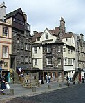
Boyd's Entry, City of Edinburgh Canongate

Geographical coordinates (GPS) Address Nearby Places
placeShow on map

Wikipedia: Burning of EdinburghContinue reading on Wikipedia

Geographical coordinates (GPS)

Latitude Longitude
N 55.95 ° E -3.1833333333333 °
placeShow on map

Address

Boyd's Entry 4
EH1 1SY City of Edinburgh, Canongate
Scotland, United Kingdom
mapOpen on Google Maps

Share experience

Nearby Places

Institute for the Study of Science, Technology and Innovation

The Institute for the Study of Science, Technology and Innovation (ISSTI) is an interdisciplinary research centre based in the UK. The research network was established in 2001 to bring together groups of academics and individual researchers across the University of Edinburgh, Edinburgh, UK. It consolidates activities in research, teaching and knowledge transfer on social and policy aspects of science, technology and innovation. ISSTI emerged from the interdisciplinary research collaboration established amongst specialist groups and scholars at the University of Edinburgh under the ESRC Programme on Information and Communications Technology, coordinated by the Research Centre for Social Sciences. Other founding members were the Sociology subject group, the Science Studies Unit, the Japanese European Technology Studies Institute (JETS) and the Entrepreneurship and Innovation group in the Business School and Economics, and the Innogen Centre. Over time this collaboration has expanded to include a wider array of scholars and specialist centres across the University including the Schools of Informatics, Law, Public Health, and Edinburgh College of Art with links also to Geosciences, Engineering and Philosophy. Today ISSTI comprises over 100 staff and research students. It constitutes one of the most interdisciplinary groupings in the field of science, technology and innovation studies measured in terms joint publication and publication outliets.

School of GeoSciences, University of Edinburgh

The University of Edinburgh School of GeoSciences, is a school within the College of Science and Engineering, which was formed in 2002 by the merger of four departments. It is split between the King's Buildings and the Central Area of the university. The institutes of Ecological Sciences and Earth Science are located at the King's Buildings, whilst the Institute of Geography is located on Drummond Street in the Central Area. In 2013 the department was ranked 8th best place to study geography in the country by The Guardian University Rankings, down from 2nd in 2006.The school is ranked as one of the best in the UK for Earth Sciences. A 2008 Research Assessment Exercise assessment ranked the "Earth Systems and Environmental Science" department as the best in the UK by number of world leading research and staff. Its Geography department was ranked 15th in the world according to the 2015 QS rankings.There are over 1100 undergraduate students and 250 postgraduate students in the School of GeoSciences. There are also around 100 research and teaching staff within the school.The School collaborates with the University of Edinburgh Business School and the School of Economics, to offer a Carbon Management MSc degree, the first in the world, which has students from over 20 countries. The school also has exchange programmes though the Erasmus programme, in addition to universities in Canada, the United States, Australia and New Zealand.The head of the School of GeoSciences is currently Professor Simon Kelley. Famous recent alumni of the School include former BP chief executive Tony Hayward. Former Rector of the university Peter McColl matriculated at one of the predecessors, the Department of Geography.Competition for entry is highly selective, in 2010, the School received 2221 applications, but only 275 offers were made, representing a 16.9% of an applicant receiving an offer. The school currently offers 11 undergraduate courses and a range of postgraduate degrees.

New College Settlement

The New College Settlement was a student settlement based on the Pleasance in the Southside of Edinburgh, Scotland. Founded by students of New College in 1893, its work continued until 1952. New College was the ministerial training college for the Free Church of Scotland. The New College Missionary Society had undertaken home mission work in deprived areas of Edinburgh since 1845, settling in the former buildings of Pleasance Free Church in 1876. In 1893, a tenement for resident student workers was added to the mission premises, establishing the mission as part of the growing settlement movement. Having previously relied on student wardens, a permanent, ordained warden, John Harry Miller, was appointed in 1908. In 1913, the settlement was constituted as Pleasance Mission Church. In 1919, this united with nearby Arthur Street United Free Church. Miller became minister of the united charge of Pleasance United Free Church, holding the role in tandem with the wardenship of the settlement. By the wake of the Second World War the Pleasance area was experiencing depopulation and the settlement closed in 1952. The settlement's buildings consisted of the former Pleasance Free Church and, next door, a tenement of 1891–1893 designed by Henry F. Kerr. The tenement is an example of both Arts and Crafts architecture and of the Old Edinburgh movement, popularised by Patrick Geddes. The buildings now form part of the University of Edinburgh's Pleasance complex.

The Pleasance (street)

The Pleasance is a street just outside the Old Town of Edinburgh, Scotland, a remnant of the Flodden Wall flanking the west side of the street between Drummond Street and the Cowgate. Historically, the street was one of the main routes into Edinburgh from the south, meeting St Mary's Wynd (now St Mary's Street) at St Mary's Wynd Port, one of the gateways of the town walls. The name derives from the Scots plesance, meaning a park or garden. It first appears in 1507 as the name of a nearby house, and was later transferred to the street and then the suburb which was part of the regality of the Canongate. The derivation of the name from a nunnery of St Mary of Placentia, often mentioned in histories of Edinburgh, is an invention by William Maitland in his 1753 History of Edinburgh.The street is largely residential - mainly 19th century tenements and 20th century flats - although the University of Edinburgh owns property in the area, including a large new [2017] university student flats complex on St Leonard's Street, the southerly extension of the Pleasance, on a site formerly occupied by a Homebase home improvements and gardening store. In addition, although the Pleasance along with St Leonard's Street is a quieter area than the nearby main commercial centres and streets of the Southside there are several restaurants, pubs, a few shops, lawyers' offices, churches, and the modern St Leonard's police station. After years of planning blight from the 1960s and 1970s in which redevelopment of the formerly rather run-down area was hampered after the abandonment of bizarre plans to build a major road comparable to a motorway, from the late 20th century onwards the area benefited from a gradual renaissance.