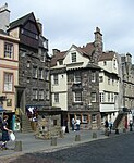
Royal Mile

The Royal Mile (Scottish Gaelic: Am Mìle Rìoghail) is a succession of streets forming the main thoroughfare of the Old Town of the city of Edinburgh in Scotland. The term was first used descriptively in W M Gilbert's Edinburgh in the Nineteenth Century (1901), "...with its Castle and Palace and the royal mile between", and was further popularised as the title of a guidebook by R T Skinner published in 1920, "The Royal Mile (Edinburgh) Castle to Holyrood(house)".The Royal Mile runs between two significant locations in the royal history of Scotland: Edinburgh Castle and Holyrood Palace. The total length of the streets between the Castle and the Palace is almost exactly a Scots mile (1.81 km), hence the name. The streets which make up the Royal Mile are (west to east) Castlehill, the Lawnmarket, the High Street, the Canongate and Abbey Strand. The Royal Mile is the busiest tourist street in the Old Town, rivalled only by Princes Street in the New Town.
Excerpt from the Wikipedia article Royal Mile (License: CC BY-SA 3.0, Authors, Images).Royal Mile
High Street, City of Edinburgh Old Town
Geographical coordinates (GPS) Address Nearby Places Show on map
Geographical coordinates (GPS)
| Latitude | Longitude |
|---|---|
| N 55.950555555556 ° | E -3.1855555555556 ° |
Address
High Street 65
EH1 1SR City of Edinburgh, Old Town
Scotland, United Kingdom
Open on Google Maps


