place

Rosh HaAyin

1949 establishments in IsraelCentral District (Israel)Cities in Central District (Israel)Cities in IsraelPages with Hebrew IPA
Populated places established in 1949Sharon plainYemeni-Jewish culture in Israel
RoshHaAyinDec052022 08

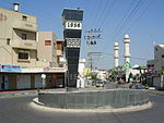
Rosh HaAyin (Hebrew: רֹאשׁ הָעַיִן, lit. '"fountainhead"', Hebrew pronunciation: [ˌʁoʃ (h)aˈ(ʔ)ajin], Arabic: روش هاعين) is a city in the Central District of Israel. In 2021, it had a population of 71,651.

Excerpt from the Wikipedia article Rosh HaAyin (License: CC BY-SA 3.0, Authors, Images).

Rosh HaAyin
Michael Garame, Rosh HaAyin HaRakafot

Geographical coordinates (GPS) Address Nearby Places
placeShow on map

Wikipedia: Rosh HaAyinContinue reading on Wikipedia

Geographical coordinates (GPS)

Latitude Longitude
N 32.095555555556 ° E 34.956666666667 °
placeShow on map

Address

מיכאל גרמה

Michael Garame
4853313 Rosh HaAyin, HaRakafot
Center District, Israel
mapOpen on Google Maps

RoshHaAyinDec052022 08
Share experience

Nearby Places

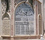
Kafr Qasim massacre
Kafr Qasim massacre

The Kafr Qasim massacre took place in the Israeli Arab village of Kafr Qasim situated on the Green Line, at that time, the de facto border between Israel and the Jordanian West Bank on October 29, 1956. It was carried out by the Israel Border Police (Magav), who killed Arab civilians returning from work during a curfew of which they were unaware, imposed earlier in the day on the eve of the Sinai War. In total 48 people died, of which 19 were men, 6 were women and 23 were children aged 8–17. Arab sources usually give the death toll as 49, as they include the unborn child of one of the women.The border policemen who were involved in the shooting were brought to trial and found guilty and sentenced to prison terms ranging from 7 to 17 years. The brigade commander was sentenced to pay the symbolic fine of 10 prutot (old Israeli cents). The Israeli court found that the command to kill civilians was "blatantly illegal". However, all of the sentences were later reduced, with some of those convicted receiving presidential pardons. All of those convicted were released no later than November 1959.One of those convicted, Gabriel Dahan, was later placed in charge of "Arab Affairs" by the city of Ramla.Issachar (Yissachar) "Yiska" Shadmi—the highest-ranking official prosecuted for the massacre—stated, shortly before his death, that he believed that his trial was staged to protect members of the Israeli political and military elite, including Prime Minister David Ben Gurion, from taking responsibility for the massacre. The purpose was to portray the perpetrators as a group of rogue soldiers, rather than people acting under higher orders.In December 2007, President of Israel Shimon Peres formally apologised for the massacre. In October 2021, a Joint List bill to have the massacre officially recognized was turned down in the Knesset.

Antipatris
Antipatris

Antipatris (Hebrew: אנטיפטריס, Ancient Greek: Αντιπατρίς) was a city built during the first century BC by Herod the Great, who named it in honour of his father, Antipater. The site, now a national park in central Israel, was inhabited from the Chalcolithic Period to the late Roman Period. The remains of Antipatris are known today as Tel Afek (תל אפק‎), although formerly as Kŭlat Râs el 'Ain. It has been identified as either the tower of Aphek mentioned by Josephus, or the biblical Aphek, best known from the story of the Battle of Aphek. During the Crusader Period the site was known as Surdi fontes, "Silent springs". The Ottoman fortress known as Binar Bashi or Ras al-Ayn was built there in the 16th century. Antipatris/Tel Afek lies at the strong perennial springs of the Yarkon River, which throughout history has created an obstacle between the hill country to the east and the Mediterranean to the west, forcing travellers and armies to pass through the narrow pass between the springs and the foothills of Samaria. This gave the location of Antipatris/Tel Afek its strategic importance. Antipatris was situated on the Roman road from Caesarea Maritima to Jerusalem, north of the town of Lydda where the road turned eastwards towards Jerusalem. During the British Mandate, a water pumping station was built there to channel water from the Yarkon to Jerusalem.Today the remains of Antipatris are located roughly between Petah Tikva and the towns of Kafr Qasim and Rosh HaAyin (literally "headspring"), south of Hod HaSharon.