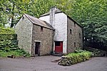
Drope
AC with 0 elementsGlamorgan geography stubsVillages in the Vale of Glamorgan

Drope is a hamlet in the valley of the River Ely in Vale of Glamorgan, southeast Wales, just beyond the territorial border of western Cardiff. It lies immediately east from Michaelston-super-Ely, west of Ely, Cardiff and southeast of St Georges-super Ely and is accessed via a bridge along Drope Road across the A4232 road to the north of Culverhouse Cross. Drope was designated a special conservation area in March 1973 by the former Glamorgan County Council due to its architectural heritage.
Excerpt from the Wikipedia article Drope (License: CC BY-SA 3.0, Authors, Images).Drope
Drope Road,
Geographical coordinates (GPS) Address Nearby Places Show on map
Geographical coordinates (GPS)
| Latitude | Longitude |
|---|---|
| N 51.474722 ° | E -3.286389 ° |
Address
Drope Road
Drope Road
CF5 6ER
Wales, United Kingdom
Open on Google Maps


